Attiches
Attiches | |
|---|---|
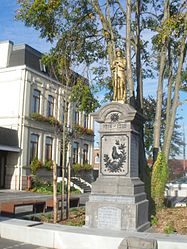 The town hall and war memorial in Attiches | |
 Coat of arms | |
show Location of Attiches | |
 Attiches | |
| Coordinates: 50°31′23″N 3°03′43″E / 50.5231°N 3.0619°ECoordinates: 50°31′23″N 3°03′43″E / 50.5231°N 3.0619°E | |
| Country | France |
| Region | Hauts-de-France |
| Department | Nord |
| Arrondissement | Lille |
| Canton | Templeuve |
| Intercommunality | Communauté de communes Pévèle-Carembault |
| Government | |
| • Mayor (2020–2026) | Luc Foutry[1] |
| Area 1 | 6.68 km2 (2.58 sq mi) |
| Population (Jan. 2018)[2] | 2,263 |
| • Density | 340/km2 (880/sq mi) |
| Time zone | UTC+01:00 (CET) |
| • Summer (DST) | UTC+02:00 (CEST) |
| INSEE/Postal code | 59022 /59551 |
| Elevation | 34–62 m (112–203 ft) (avg. 60 m or 200 ft) |
| 1 French Land Register data, which excludes lakes, ponds, glaciers > 1 km2 (0.386 sq mi or 247 acres) and river estuaries. | |


Attiches is a commune in the Nord department in northern France.
Population[]
|
|
Heraldry[]
 |
The arms of Attiches are blazoned : Or, a bend chequy gules and argent of 2 traits.
|
See also[]
References[]
- ^ "Répertoire national des élus: les maires". data.gouv.fr, Plateforme ouverte des données publiques françaises (in French). 2 December 2020.
- ^ "Populations légales 2018". INSEE. 28 December 2020.
| Wikimedia Commons has media related to Attiches. |
| show Authority control |
|---|
This Nord geographical article is a stub. You can help Wikipedia by . |
Categories:
- Communes of Nord (French department)
- Nord (French department) geography stubs