Bachy
Bachy | |
|---|---|
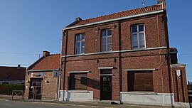 Town hall | |
 Coat of arms | |
show Location of Bachy | |
 Bachy | |
| Coordinates: 50°33′04″N 3°15′39″E / 50.5511°N 3.2608°ECoordinates: 50°33′04″N 3°15′39″E / 50.5511°N 3.2608°E | |
| Country | France |
| Region | Hauts-de-France |
| Department | Nord |
| Arrondissement | Lille |
| Canton | Templeuve |
| Intercommunality | Pévèle Carembault |
| Government | |
| • Mayor (2020–2026) | Philippe Delcourt[1] |
| Area 1 | 6.41 km2 (2.47 sq mi) |
| Population (Jan. 2018)[2] | 1,747 |
| • Density | 270/km2 (710/sq mi) |
| Time zone | UTC+01:00 (CET) |
| • Summer (DST) | UTC+02:00 (CEST) |
| INSEE/Postal code | 59042 /59830 |
| Elevation | 31–74 m (102–243 ft) (avg. 73 m or 240 ft) |
| 1 French Land Register data, which excludes lakes, ponds, glaciers > 1 km2 (0.386 sq mi or 247 acres) and river estuaries. | |


Bachy is a commune in the Nord department in northern France.
Population[]
| Year | Pop. | ±% |
|---|---|---|
| 2005 | 1,395 | — |
| 2006 | 1,399 | +0.3% |
| 2007 | 1,411 | +0.9% |
| 2008 | 1,424 | +0.9% |
| 2009 | 1,436 | +0.8% |
| 2010 | 1,448 | +0.8% |
| 2011 | 1,477 | +2.0% |
| 2012 | 1,591 | +7.7% |
| 2013 | 1,605 | +0.9% |
| 2014 | 1,618 | +0.8% |
| 2015 | 1,631 | +0.8% |
| 2016 | 1,690 | +3.6% |
Heraldry[]
 |
The arms of Bachy are blazoned : Gules, on a chief Or, in dexter a lion sable.
|
See also[]
References[]
- ^ "Répertoire national des élus: les maires". data.gouv.fr, Plateforme ouverte des données publiques françaises (in French). 2 December 2020.
- ^ "Populations légales 2018". INSEE. 28 December 2020.
| Wikimedia Commons has media related to Bachy. |
| show Authority control |
|---|
This Nord geographical article is a stub. You can help Wikipedia by . |
Categories:
- Communes of Nord (French department)
- Nord (French department) geography stubs