Bellaing
Bellaing | |
|---|---|
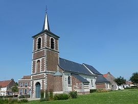 The church in Bellaing | |
 Coat of arms | |
show Location of Bellaing | |
 Bellaing | |
| Coordinates: 50°22′09″N 3°25′36″E / 50.3692°N 3.4267°ECoordinates: 50°22′09″N 3°25′36″E / 50.3692°N 3.4267°E | |
| Country | France |
| Region | Hauts-de-France |
| Department | Nord |
| Arrondissement | Valenciennes |
| Canton | Aulnoy-lez-Valenciennes |
| Intercommunality | CA Porte du Hainaut |
| Government | |
| • Mayor (2020–2026) | Michel Blaise[1] |
| Area 1 | 3.42 km2 (1.32 sq mi) |
| Population (Jan. 2018)[2] | 1,252 |
| • Density | 370/km2 (950/sq mi) |
| Time zone | UTC+01:00 (CET) |
| • Summer (DST) | UTC+02:00 (CEST) |
| INSEE/Postal code | 59064 /59135 |
| Elevation | 21–47 m (69–154 ft) (avg. 42 m or 138 ft) |
| 1 French Land Register data, which excludes lakes, ponds, glaciers > 1 km2 (0.386 sq mi or 247 acres) and river estuaries. | |


Bellaing is a commune in the Nord department in northern France.
Population[]
|
|
Heraldry[]
 |
The arms of Bellaing are blazoned : Quarterly 1&4: Argent, a fess sable; 2&3: Or, a cross moline sable. (Bellaing, Oisy and Preux-au-Bois use the same arms.)
|
See also[]
References[]
- ^ "Répertoire national des élus: les maires". data.gouv.fr, Plateforme ouverte des données publiques françaises (in French). 2 December 2020.
- ^ "Populations légales 2018". INSEE. 28 December 2020.
| Wikimedia Commons has media related to Bellaing. |
| show Authority control |
|---|
This Nord geographical article is a stub. You can help Wikipedia by . |
Categories:
- Communes of Nord (French department)
- Nord (French department) geography stubs