Moncheaux
Moncheaux | |
|---|---|
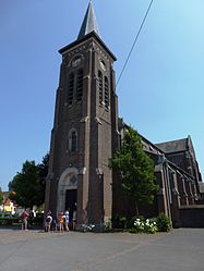 The church in Moncheaux | |
 Coat of arms | |
show Location of Moncheaux | |
 Moncheaux | |
| Coordinates: 50°27′12″N 3°04′49″E / 50.4534°N 3.0803°ECoordinates: 50°27′12″N 3°04′49″E / 50.4534°N 3.0803°E | |
| Country | France |
| Region | Hauts-de-France |
| Department | Nord |
| Arrondissement | Lille |
| Canton | Templeuve |
| Intercommunality | Communauté de communes Pévèle-Carembault |
| Government | |
| • Mayor (2014-2020) | Jeannette Willocq-Facq |
| Area 1 | 4.97 km2 (1.92 sq mi) |
| Population (Jan. 2018)[1] | 1,583 |
| • Density | 320/km2 (820/sq mi) |
| Time zone | UTC+01:00 (CET) |
| • Summer (DST) | UTC+02:00 (CEST) |
| INSEE/Postal code | 59408 /59283 |
| Elevation | 37–76 m (121–249 ft) (avg. 75 m or 246 ft) |
| 1 French Land Register data, which excludes lakes, ponds, glaciers > 1 km2 (0.386 sq mi or 247 acres) and river estuaries. | |


Moncheaux is a commune in the Nord department in northern France.
Heraldry[]
 |
The arms of Moncheaux are blazoned : Vert, the name 'Monceaux' bendwise between 2 bendlets Or, and in (sinister) chief an inescutcheon gironny of 12 Or and azure charged with another inecutcheon gules. Note: it does say Monceaux not Moncheaux.
|
See also[]
References[]
- ^ "Populations légales 2018". INSEE. 28 December 2020.
| Wikimedia Commons has media related to Moncheaux. |
| show Authority control |
|---|
This Nord geographical article is a stub. You can help Wikipedia by . |
Categories:
- Communes of Nord (French department)
- Nord (French department) geography stubs