Thiant
Thiant | |
|---|---|
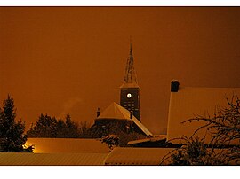 The church in Thiant | |
 Coat of arms | |
show Location of Thiant | |
 Thiant | |
| Coordinates: 50°18′23″N 3°26′57″E / 50.3064°N 3.4492°ECoordinates: 50°18′23″N 3°26′57″E / 50.3064°N 3.4492°E | |
| Country | France |
| Region | Hauts-de-France |
| Department | Nord |
| Arrondissement | Valenciennes |
| Canton | Aulnoy-lez-Valenciennes |
| Intercommunality | CA Porte du Hainaut |
| Government | |
| • Mayor (2020–2026) | Jean-Marie Lecerf |
| Area 1 | 8.39 km2 (3.24 sq mi) |
| Population (Jan. 2018)[1] | 2,998 |
| • Density | 360/km2 (930/sq mi) |
| Time zone | UTC+01:00 (CET) |
| • Summer (DST) | UTC+02:00 (CEST) |
| INSEE/Postal code | 59589 /59224 |
| Elevation | 26–72 m (85–236 ft) (avg. 31 m or 102 ft) |
| 1 French Land Register data, which excludes lakes, ponds, glaciers > 1 km2 (0.386 sq mi or 247 acres) and river estuaries. | |


Thiant (French pronunciation: [tjɑ̃]) is a commune in the Nord department in northern France.
Heraldry[]
 |
The arms of Thiant are blazoned : Vert, billetty, a lion argent, armed and langued gules. (Thiant and Aubry-du-Hainaut use the same arms.)
|
See also[]
References[]
- ^ "Populations légales 2018". INSEE. 28 December 2020.
| Wikimedia Commons has media related to Thiant. |
| show Authority control |
|---|
This Nord geographical article is a stub. You can help Wikipedia by . |
Categories:
- Communes of Nord (French department)
- Nord (French department) geography stubs