Andres, Pas-de-Calais
Andres
Anderne | |
|---|---|
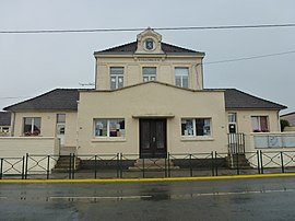 The school and former town hall of Andres | |
 Coat of arms | |
show Location of Andres | |
 Andres | |
| Coordinates: 50°52′05″N 1°55′18″E / 50.8681°N 1.9217°ECoordinates: 50°52′05″N 1°55′18″E / 50.8681°N 1.9217°E | |
| Country | France |
| Region | Hauts-de-France |
| Department | Pas-de-Calais |
| Arrondissement | Calais |
| Canton | Calais-2 |
| Intercommunality | CC des Pays d'Opale |
| Government | |
| • Mayor (2021–2026) | Allan Turpin[1] |
| Area 1 | 7.15 km2 (2.76 sq mi) |
| Population (Jan. 2018)[2] | 1,556 |
| • Density | 220/km2 (560/sq mi) |
| Time zone | UTC+01:00 (CET) |
| • Summer (DST) | UTC+02:00 (CEST) |
| INSEE/Postal code | 62031 /62340 |
| Elevation | 1–34 m (3.3–111.5 ft) (avg. 6 m or 20 ft) |
| 1 French Land Register data, which excludes lakes, ponds, glaciers > 1 km2 (0.386 sq mi or 247 acres) and river estuaries. | |


Andres (West Flemish: Anderne) is a commune in the Pas-de-Calais department in northern France.
Geography[]
Andres is a farming village located 8 miles (13 km) southeast of Calais, at the junction of the D244 and D248 roads.
Population[]
| Year | Pop. | ±% |
|---|---|---|
| 1962 | 734 | — |
| 1968 | 759 | +3.4% |
| 1975 | 697 | −8.2% |
| 1982 | 1,007 | +44.5% |
| 1990 | 1,396 | +38.6% |
| 1999 | 1,445 | +3.5% |
| 2005 | 1,505 | +4.2% |
| 2009 | 1,520 | +1.0% |
| 2010 | 1,515 | −0.3% |
| 2014 | 1,556 | +2.7% |
| 2015 | 1,574 | +1.2% |
Sights[]
- The church of St. John, dating from the eighteenth century.
- The tower of an old windmill.
See also[]
References[]
- ^ "Répertoire national des élus: les maires". data.gouv.fr, Plateforme ouverte des données publiques françaises (in French). 9 August 2021.
- ^ "Populations légales 2018". INSEE. 28 December 2020.
| Wikimedia Commons has media related to Andres. |
This Pas-de-Calais geographical article is a stub. You can help Wikipedia by . |
Categories:
- Communes of Pas-de-Calais
- Pale of Calais
- Pas-de-Calais geography stubs