Béthonsart
From Wikipedia, the free encyclopedia
Commune in Hauts-de-France, France
Béthonsart | |
|---|---|
 The church of Béthonsart | |
 Coat of arms | |
 Béthonsart  Béthonsart | |
Coordinates:  50°22′36″N 2°33′04″E / 50.3767°N 2.5511°E / 50.3767; 2.5511Coordinates: 50°22′36″N 2°33′04″E / 50.3767°N 2.5511°E / 50.3767; 2.5511 50°22′36″N 2°33′04″E / 50.3767°N 2.5511°E / 50.3767; 2.5511Coordinates: 50°22′36″N 2°33′04″E / 50.3767°N 2.5511°E / 50.3767; 2.5511 | |
| Country | France |
| Region | Hauts-de-France |
| Department | Pas-de-Calais |
| Arrondissement | Arras |
| Canton | Avesnes-le-Comte |
| Intercommunality | Communauté de communes des Campagnes de l'Artois |
| Government | |
| • Mayor (2014-2020) | Alain Hugot |
| Area 1 | 4.21 km2 (1.63 sq mi) |
| Population (Jan. 2018)[1] | 144 |
| • Density | 34/km2 (89/sq mi) |
| Time zone | UTC+01:00 (CET) |
| • Summer (DST) | UTC+02:00 (CEST) |
| INSEE/Postal code | 62118 /62690 |
| Elevation | 119–157 m (390–515 ft) (avg. 144 m or 472 ft) |
| 1 French Land Register data, which excludes lakes, ponds, glaciers > 1 km2 (0.386 sq mi or 247 acres) and river estuaries. | |

Béthonsart is a commune in the Pas-de-Calais department in the Hauts-de-France region in northern France.
Geography[]
A small farming village located 12 miles (20 km) northwest of Arras on the D74.
Population[]
| Year | Pop. | ±% |
|---|---|---|
| 1962 | 167 | — |
| 1968 | 152 | −9.0% |
| 1975 | 127 | −16.4% |
| 1982 | 126 | −0.8% |
| 1990 | 141 | +11.9% |
| 1999 | 131 | −7.1% |
| 2006 | 159 | +21.4% |
| 2007 | 163 | +2.5% |
| 2008 | 167 | +2.5% |
| 2009 | 167 | +0.0% |
| 2013 | 156 | −6.6% |
| 2015 | 154 | −1.3% |
Sights[]
- A seventeenth-century farmhouse.
- The church of St. Elizabeth, dating from the sixteenth century
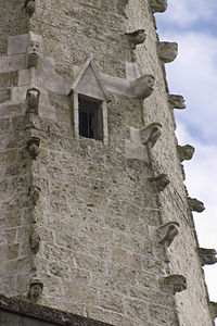
Detail of the spire
See also[]
References[]
- ^ "Populations légales 2018". INSEE. 28 December 2020.
| Wikimedia Commons has media related to Béthonsart. |
show
Communes of the Pas-de-Calais department | |
|---|---|
|
This Arras arrondissement, Pas-de-Calais geographical article is a stub. You can help Wikipedia by . |
- v
- t
Retrieved from ""
Categories:
- Communes of Pas-de-Calais
- Arras arrondissement geography stubs
Hidden categories:
- Articles with short description
- Short description is different from Wikidata
- Coordinates on Wikidata
- Pages using infobox settlement with image map1 but not image map
- Commons category link is on Wikidata
- Articles with BNF identifiers
- All stub articles
- Pages using the Kartographer extension