Gouves
From Wikipedia, the free encyclopedia
For a place in Greece, see Gouves, Greece.
Commune in Hauts-de-France, France
Gouves | |
|---|---|
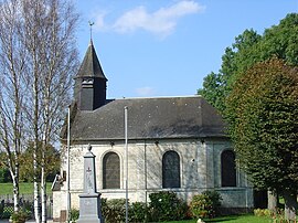 The church of Gouves | |
 Coat of arms | |
 Gouves  Gouves | |
Coordinates:  50°17′56″N 2°38′12″E / 50.2989°N 2.6367°E / 50.2989; 2.6367Coordinates: 50°17′56″N 2°38′12″E / 50.2989°N 2.6367°E / 50.2989; 2.6367 50°17′56″N 2°38′12″E / 50.2989°N 2.6367°E / 50.2989; 2.6367Coordinates: 50°17′56″N 2°38′12″E / 50.2989°N 2.6367°E / 50.2989; 2.6367 | |
| Country | France |
| Region | Hauts-de-France |
| Department | Pas-de-Calais |
| Arrondissement | Arras |
| Canton | Avesnes-le-Comte |
| Intercommunality | CC Campagnes de l'Artois |
| Government | |
| • Mayor (2008–2014) | Alain Philippe |
| Area 1 | 2.64 km2 (1.02 sq mi) |
| Population (Jan. 2018)[1] | 197 |
| • Density | 75/km2 (190/sq mi) |
| Time zone | UTC+01:00 (CET) |
| • Summer (DST) | UTC+02:00 (CEST) |
| INSEE/Postal code | 62378 /62123 |
| Elevation | 72–124 m (236–407 ft) (avg. 75 m or 246 ft) |
| 1 French Land Register data, which excludes lakes, ponds, glaciers > 1 km2 (0.386 sq mi or 247 acres) and river estuaries. | |

Gouves is a commune in the Pas-de-Calais department in the Hauts-de-France region of France.
Geography[]
A farming village situated 6 miles (9.7 km) west of Arras, at the junction of the D56 and C5 roads, in the valley of the small river Gy.
Population[]
| Year | 1962 | 1968 | 1975 | 1982 | 1990 | 1999 |
|---|---|---|---|---|---|---|
| Population | 102 | 93 | 95 | 179 | 174 | 198 |
| From the year 1962 on: No double counting—residents of multiple communes (e.g. students and military personnel) are counted only once. | ||||||
Places of interest[]
- The church (and the fountain) of St.Maclou, dating from the nineteenth century.
- Traces of an old castle.
See also[]
References[]
- ^ "Populations légales 2018". INSEE. 28 December 2020.
External links[]
| Wikimedia Commons has media related to Gouves. |
- Website of the “Entente Gouvoise” (in French)
show
Communes of the Pas-de-Calais department | |
|---|---|
|
This Arras arrondissement, Pas-de-Calais geographical article is a stub. You can help Wikipedia by . |
- v
- t
Retrieved from ""
Categories:
- Communes of Pas-de-Calais
- Arras arrondissement geography stubs
Hidden categories:
- Articles with short description
- Short description is different from Wikidata
- Infobox mapframe without OSM relation ID on Wikidata
- Coordinates on Wikidata
- Pages using infobox settlement with image map1 but not image map
- Commons category link from Wikidata
- Articles with French-language sources (fr)
- Articles with BNF identifiers
- All stub articles
- Pages using the Kartographer extension