Lattre-Saint-Quentin
Lattre-Saint-Quentin | |
|---|---|
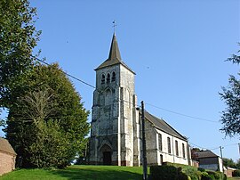 The church of Lattre-Saint-Quentin | |
 Coat of arms | |
show Location of Lattre-Saint-Quentin | |
 Lattre-Saint-Quentin | |
| Coordinates: 50°17′21″N 2°34′53″E / 50.2892°N 2.5814°ECoordinates: 50°17′21″N 2°34′53″E / 50.2892°N 2.5814°E | |
| Country | France |
| Region | Hauts-de-France |
| Department | Pas-de-Calais |
| Arrondissement | Arras |
| Canton | Avesnes-le-Comte |
| Intercommunality | CC Campagnes de l'Artois |
| Government | |
| • Mayor (2008–2014) | Bernard Têtu |
| Area 1 | 7.63 km2 (2.95 sq mi) |
| Population (Jan. 2018)[1] | 268 |
| • Density | 35/km2 (91/sq mi) |
| Time zone | UTC+01:00 (CET) |
| • Summer (DST) | UTC+02:00 (CEST) |
| INSEE/Postal code | 62490 /62810 |
| Elevation | 87–132 m (285–433 ft) (avg. 125 m or 410 ft) |
| 1 French Land Register data, which excludes lakes, ponds, glaciers > 1 km2 (0.386 sq mi or 247 acres) and river estuaries. | |


Lattre-Saint-Quentin is a commune in the Pas-de-Calais department in the Hauts-de-France region of France.
Geography[]
A small farming village situated 10 miles (16 km) west of Arras, at the junction of the D66 and the D339 roads.
Population[]
| Year | 1962 | 1968 | 1975 | 1982 | 1990 | 1999 | 2006 |
|---|---|---|---|---|---|---|---|
| Population | 199 | 202 | 157 | 180 | 191 | 193 | 227 |
| From the year 1962 on: No double counting—residents of multiple communes (e.g. students and military personnel) are counted only once. | |||||||
Places of interest[]
- The church of St.Quentin, dating from the thirteenth century.
- An eighteenth century manor house and farm.
- Traces of an old castle.
See also[]
References[]
- ^ "Populations légales 2018". INSEE. 28 December 2020.
| Wikimedia Commons has media related to Lattre-Saint-Quentin. |
This Arras arrondissement, Pas-de-Calais geographical article is a stub. You can help Wikipedia by . |
Categories:
- Communes of Pas-de-Calais
- Arras arrondissement geography stubs