Hardinghen
From Wikipedia, the free encyclopedia
Commune in Hauts-de-France, France
Hardinghen | |
|---|---|
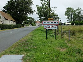 The road into Hardinghen | |
 Coat of arms | |
 Hardinghen  Hardinghen | |
Coordinates:  50°48′39″N 1°49′21″E / 50.8108°N 1.8225°E / 50.8108; 1.8225Coordinates: 50°48′39″N 1°49′21″E / 50.8108°N 1.8225°E / 50.8108; 1.8225 50°48′39″N 1°49′21″E / 50.8108°N 1.8225°E / 50.8108; 1.8225Coordinates: 50°48′39″N 1°49′21″E / 50.8108°N 1.8225°E / 50.8108; 1.8225 | |
| Country | France |
| Region | Hauts-de-France |
| Department | Pas-de-Calais |
| Arrondissement | Calais |
| Canton | Calais-2 |
| Intercommunality | CC Pays d'Opale |
| Government | |
| • Mayor (2008–2014) | Didier Devin |
| Area 1 | 8.24 km2 (3.18 sq mi) |
| Population (Jan. 2018)[1] | 1,215 |
| • Density | 150/km2 (380/sq mi) |
| Time zone | UTC+01:00 (CET) |
| • Summer (DST) | UTC+02:00 (CEST) |
| INSEE/Postal code | 62412 /62132 |
| Elevation | 48–176 m (157–577 ft) (avg. 70 m or 230 ft) |
| 1 French Land Register data, which excludes lakes, ponds, glaciers > 1 km2 (0.386 sq mi or 247 acres) and river estuaries. | |

Hardinghen is a commune in the Pas-de-Calais department in the Hauts-de-France region of France.
Geography[]
A farming village located 12 miles (18 km) south of Calais, at the junction of the D127 and D191 roads.
Population[]
| Year | 1962 | 1968 | 1975 | 1982 | 1990 | 1999 | 2004 |
|---|---|---|---|---|---|---|---|
| Population | 923 | 1089 | 1084 | 1056 | 1013 | 1008 | 1012 |
| From the year 1962 on: No double counting—residents of multiple communes (e.g. students and military personnel) are counted only once. | |||||||
Places of interest[]
- The church of St. Marguerite, rebuilt in the 19th century.
- A château dating from the eighteenth century.
- The eighteenth-century château de la Trésorerie, destroyed in 2006.
- Hardinghen also has an annual fête.
References[]
- ^ "Populations légales 2018". INSEE. 28 December 2020.
| Wikimedia Commons has media related to Hardinghen. |
show
Communes of the Pas-de-Calais department | |
|---|---|
|
This Arras arrondissement, Pas-de-Calais geographical article is a stub. You can help Wikipedia by . |
- v
- t
Retrieved from ""
Categories:
- Communes of Pas-de-Calais
- Arras arrondissement geography stubs
Hidden categories:
- Articles with short description
- Short description is different from Wikidata
- Coordinates on Wikidata
- Pages using infobox settlement with image map1 but not image map
- Commons category link from Wikidata
- Articles with BNF identifiers
- All stub articles
- Pages using the Kartographer extension