Saint-Martin-lez-Tatinghem
From Wikipedia, the free encyclopedia
Commune in Hauts-de-France, France
Saint-Martin-lez-Tatinghem
Sint-Maartens-en-Tatingem | |
|---|---|
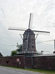 The windmill of Saint-Martin | |
Location of Saint-Martin-lez-Tatinghem  | |
 Saint-Martin-lez-Tatinghem  Saint-Martin-lez-Tatinghem | |
Coordinates:  50°45′14″N 2°14′17″E / 50.754°N 2.238°E / 50.754; 2.238Coordinates: 50°45′14″N 2°14′17″E / 50.754°N 2.238°E / 50.754; 2.238 50°45′14″N 2°14′17″E / 50.754°N 2.238°E / 50.754; 2.238Coordinates: 50°45′14″N 2°14′17″E / 50.754°N 2.238°E / 50.754; 2.238 | |
| Country | France |
| Region | Hauts-de-France |
| Department | Pas-de-Calais |
| Arrondissement | Saint-Omer |
| Canton | Saint-Omer |
| Intercommunality | Pays de Saint-Omer |
| Government | |
| • Mayor (2020–2026) | Bertrand Petit[1] |
| Area 1 | 11.54 km2 (4.46 sq mi) |
| Population (Jan. 2018)[2] | 5,914 |
| • Density | 510/km2 (1,300/sq mi) |
| Time zone | UTC+01:00 (CET) |
| • Summer (DST) | UTC+02:00 (CEST) |
| INSEE/Postal code | 62757 /62500 |
| 1 French Land Register data, which excludes lakes, ponds, glaciers > 1 km2 (0.386 sq mi or 247 acres) and river estuaries. | |
Saint-Martin-lez-Tatinghem (West Flemish: Sint-Maartens-en-Tatingem) is a commune in the Pas-de-Calais department of northern France. The municipality was established on 1 January 2016 and consists of the former communes of Saint-Martin-au-Laërt and Tatinghem.[3]
See also[]
References[]
| Wikimedia Commons has media related to Saint-Martin-lez-Tatinghem. |
- ^ Maires au 17-06-2020, data.gouv.fr, accessed 7 December 2020
- ^ "Populations légales 2018". The National Institute of Statistics and Economic Studies. 28 December 2020.
- ^ Arrêté préfectoral 23 December 2015 (in French)
Communes of the Pas-de-Calais department | |
|---|---|
|
This Pas-de-Calais geographical article is a stub. You can help Wikipedia by . |
- v
- t
Retrieved from ""
Categories:
- Communes of Pas-de-Calais
- Pas-de-Calais geography stubs
Hidden categories:
- Articles with French-language sources (fr)
- Articles with short description
- Short description is different from Wikidata
- Infobox mapframe without OSM relation ID on Wikidata
- Coordinates on Wikidata
- Pages using infobox settlement with image map1 but not image map
- Articles containing West Flemish-language text
- Commons category link is on Wikidata
- AC with 0 elements
- All stub articles
- Pages using the Kartographer extension