Hesdigneul-lès-Béthune
Hesdigneul-lès-Béthune | |
|---|---|
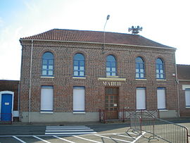 The town hall of Hesdigneul-lès-Béthune | |
 Coat of arms | |
show Location of Hesdigneul-lès-Béthune | |
 Hesdigneul-lès-Béthune | |
| Coordinates: 50°30′07″N 2°35′31″E / 50.5019°N 2.5919°ECoordinates: 50°30′07″N 2°35′31″E / 50.5019°N 2.5919°E | |
| Country | France |
| Region | Hauts-de-France |
| Department | Pas-de-Calais |
| Arrondissement | Béthune |
| Canton | Nœux-les-Mines |
| Intercommunality | CA Béthune-Bruay, Artois-Lys Romane |
| Government | |
| • Mayor (2020–2026) | Maurice Lecomte[1] |
| Area 1 | 2.59 km2 (1.00 sq mi) |
| Population (Jan. 2018)[2] | 823 |
| • Density | 320/km2 (820/sq mi) |
| Time zone | UTC+01:00 (CET) |
| • Summer (DST) | UTC+02:00 (CEST) |
| INSEE/Postal code | 62445 /62196 |
| Elevation | 32–61 m (105–200 ft) (avg. 115 m or 377 ft) |
| 1 French Land Register data, which excludes lakes, ponds, glaciers > 1 km2 (0.386 sq mi or 247 acres) and river estuaries. | |


Hesdigneul-lès-Béthune is a commune in the Pas-de-Calais department in the Hauts-de-France region of France.
Geography[]
A small farming village, situated some 3 miles (4.8 km) southwest of Béthune at the junction of the D181 and the D941 roads and one mile from junction 6 of the A26 autoroute.
Population[]
| Year | 1962 | 1968 | 1975 | 1982 | 1990 | 1999 | 2006 |
|---|---|---|---|---|---|---|---|
| Population | 817 | 896 | 843 | 759 | 791 | 771 | 829 |
| From the year 1962 on: No double counting—residents of multiple communes (e.g. students and military personnel) are counted only once. | |||||||
Places of interest[]
- The church of St. Denis, dating from the sixteenth century.
- The vestiges of an eighteenth-century chateau and its outbuildings.
See also[]
References[]
- ^ "Répertoire national des élus: les maires". data.gouv.fr, Plateforme ouverte des données publiques françaises (in French). 2 December 2020.
- ^ "Populations légales 2018". INSEE. 28 December 2020.
| Wikimedia Commons has media related to Hesdigneul-lès-Béthune. |
This Pas-de-Calais geographical article is a stub. You can help Wikipedia by . |
Categories:
- Communes of Pas-de-Calais
- Pas-de-Calais geography stubs