Gauchin-Légal
Gauchin-Légal | |
|---|---|
 The church of Gauchin-Légal | |
show Location of Gauchin-Légal | |
 Gauchin-Légal | |
| Coordinates: 50°24′56″N 2°34′58″E / 50.4156°N 2.5828°ECoordinates: 50°24′56″N 2°34′58″E / 50.4156°N 2.5828°E | |
| Country | France |
| Region | Hauts-de-France |
| Department | Pas-de-Calais |
| Arrondissement | Béthune |
| Canton | Bruay-la-Buissière |
| Intercommunality | CA Béthune-Bruay, Artois-Lys Romane |
| Government | |
| • Mayor (2020–2026) | Dominique Voiseux[1] |
| Area 1 | 6.03 km2 (2.33 sq mi) |
| Population (Jan. 2018)[2] | 315 |
| • Density | 52/km2 (140/sq mi) |
| Time zone | UTC+01:00 (CET) |
| • Summer (DST) | UTC+02:00 (CEST) |
| INSEE/Postal code | 62366 /62150 |
| Elevation | 85–167 m (279–548 ft) (avg. 93 m or 305 ft) |
| 1 French Land Register data, which excludes lakes, ponds, glaciers > 1 km2 (0.386 sq mi or 247 acres) and river estuaries. | |


Gauchin-Légal (or Gauchin-le-Gal) is a commune in the Pas-de-Calais department in the Hauts-de-France region of France.
Geography[]
A farming village situated some 10 miles (16.1 km) south of Béthune and 29 miles (46.7 km) southwest of Lille, at the junction of the D73 and the D341 roads. A small stream, the ‘ruisseau Caucourt’, a tributary of the river Lawe, flows through the village.
Population[]
| Year | 1962 | 1968 | 1975 | 1982 | 1990 | 1999 | 2012 |
|---|---|---|---|---|---|---|---|
| Population | 271 | 272 | 245 | 227 | 296 | 331 | 337 |
| From the year 1962 on: No double counting—residents of multiple communes (e.g. students and military personnel) are counted only once. | |||||||
Places of interest[]
- "Le Gal", a sandstone rock chained to another on the village square.
- The church of St. Joseph, dating from the sixteenth century.
- The eighteenth-century château.

Le gal de Gauchin
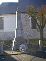
Monument to war dead


See also[]
References[]
- ^ "Répertoire national des élus: les maires". data.gouv.fr, Plateforme ouverte des données publiques françaises (in French). 2 December 2020.
- ^ "Populations légales 2018". INSEE. 28 December 2020.
| Wikimedia Commons has media related to Gauchin-Légal. |
This Pas-de-Calais geographical article is a stub. You can help Wikipedia by . |
Categories:
- Communes of Pas-de-Calais
- Pas-de-Calais geography stubs