Ivergny
From Wikipedia, the free encyclopedia
Commune in Hauts-de-France, France
Ivergny | |
|---|---|
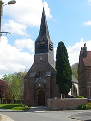 The church of Ivergny | |
 Coat of arms | |
 Ivergny  Ivergny | |
Coordinates:  50°14′23″N 2°23′36″E / 50.2397°N 2.3933°E / 50.2397; 2.3933Coordinates: 50°14′23″N 2°23′36″E / 50.2397°N 2.3933°E / 50.2397; 2.3933 50°14′23″N 2°23′36″E / 50.2397°N 2.3933°E / 50.2397; 2.3933Coordinates: 50°14′23″N 2°23′36″E / 50.2397°N 2.3933°E / 50.2397; 2.3933 | |
| Country | France |
| Region | Hauts-de-France |
| Department | Pas-de-Calais |
| Arrondissement | Arras |
| Canton | Avesnes-le-Comte |
| Intercommunality | CC Campagnes de l'Artois |
| Government | |
| • Mayor (2020–2026) | Jean-Claude Jacquemelle |
| Area 1 | 7.34 km2 (2.83 sq mi) |
| Population (Jan. 2018)[1] | 254 |
| • Density | 35/km2 (90/sq mi) |
| Time zone | UTC+01:00 (CET) |
| • Summer (DST) | UTC+02:00 (CEST) |
| INSEE/Postal code | 62475 /62810 |
| Elevation | 109–159 m (358–522 ft) (avg. 150 m or 490 ft) |
| 1 French Land Register data, which excludes lakes, ponds, glaciers > 1 km2 (0.386 sq mi or 247 acres) and river estuaries. | |

Ivergny is a commune in the Pas-de-Calais department in northern France. It is located approximately 40 km north of Amiens.[2]
See also[]
References[]
- ^ "Populations légales 2018". INSEE. 28 December 2020.
- ^ INSEE commune file Accessed November 8, 2012.
External links[]
| Wikimedia Commons has media related to Ivergny. |
show
Communes of the Pas-de-Calais department | |
|---|---|
|
This Arras arrondissement, Pas-de-Calais geographical article is a stub. You can help Wikipedia by . |
- v
- t
Retrieved from ""
Categories:
- Communes of Pas-de-Calais
- Arras arrondissement geography stubs
Hidden categories:
- Articles with short description
- Short description is different from Wikidata
- Infobox mapframe without OSM relation ID on Wikidata
- Coordinates on Wikidata
- Pages using infobox settlement with image map1 but not image map
- Commons category link from Wikidata
- Articles with BNF identifiers
- All stub articles
- Pages using the Kartographer extension