Hendecourt-lès-Cagnicourt
Hendecourt-lès-Cagnicourt | |
|---|---|
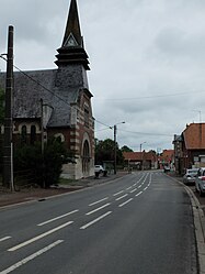 The main road of Hendecourt-lès-Cagnicourt | |
 Coat of arms | |
show Location of Hendecourt-lès-Cagnicourt | |
 Hendecourt-lès-Cagnicourt | |
| Coordinates: 50°12′38″N 2°56′57″E / 50.2106°N 2.9492°ECoordinates: 50°12′38″N 2°56′57″E / 50.2106°N 2.9492°E | |
| Country | France |
| Region | Hauts-de-France |
| Department | Pas-de-Calais |
| Arrondissement | Arras |
| Canton | Brebières |
| Intercommunality | CC Osartis Marquion |
| Government | |
| • Mayor (2020–2026) | Denis Sénéchal[1] |
| Area 1 | 8.86 km2 (3.42 sq mi) |
| Population (Jan. 2018)[2] | 314 |
| • Density | 35/km2 (92/sq mi) |
| Time zone | UTC+01:00 (CET) |
| • Summer (DST) | UTC+02:00 (CEST) |
| INSEE/Postal code | 62424 /62182 |
| Elevation | 61–92 m (200–302 ft) (avg. 72 m or 236 ft) |
| 1 French Land Register data, which excludes lakes, ponds, glaciers > 1 km2 (0.386 sq mi or 247 acres) and river estuaries. | |


Hendecourt-lès-Cagnicourt is a commune in the Pas-de-Calais department in the Hauts-de-France region of France.
Geography[]
Hendecourt-lès-Cagnicourt is situated 11 miles (18 km) southeast of Arras, at the junction of the D38 and the D956 roads.
Population[]
| Year | 1962 | 1968 | 1975 | 1982 | 1990 | 1999 | 2007 |
|---|---|---|---|---|---|---|---|
| Population | 308 | 328 | 321 | 310 | 292 | 286 | 321 |
| From the year 1962 on: No double counting—residents of multiple communes (e.g. students and military personnel) are counted only once. | |||||||
Places of interest[]
- The church of St.Leger, rebuilt along with the rest of the village, after World War I.
- The Commonwealth War Graves Commission cemeteries.
See also[]
References[]
- ^ "Répertoire national des élus: les maires". data.gouv.fr, Plateforme ouverte des données publiques françaises (in French). 2 December 2020.
- ^ "Populations légales 2018". INSEE. 28 December 2020.
External links[]
| Wikimedia Commons has media related to Hendecourt-lès-Cagnicourt. |
This Arras arrondissement, Pas-de-Calais geographical article is a stub. You can help Wikipedia by . |
Categories:
- Communes of Pas-de-Calais
- Arras arrondissement geography stubs