Hamblain-les-Prés
Hamblain-les-Prés | |
|---|---|
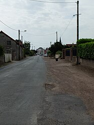 A road in Hamblain-les-Prés | |
 Coat of arms | |
show Location of Hamblain-les-Prés | |
 Hamblain-les-Prés | |
| Coordinates: 50°17′38″N 2°57′41″E / 50.2939°N 2.9614°ECoordinates: 50°17′38″N 2°57′41″E / 50.2939°N 2.9614°E | |
| Country | France |
| Region | Hauts-de-France |
| Department | Pas-de-Calais |
| Arrondissement | Arras |
| Canton | Brebières |
| Intercommunality | CC Osartis Marquion |
| Government | |
| • Mayor (2020–2026) | Patrick Deregnaucourt |
| Area 1 | 4.87 km2 (1.88 sq mi) |
| Population (Jan. 2018)[1] | 493 |
| • Density | 100/km2 (260/sq mi) |
| Time zone | UTC+01:00 (CET) |
| • Summer (DST) | UTC+02:00 (CEST) |
| INSEE/Postal code | 62405 /62118 |
| Elevation | 41–73 m (135–240 ft) (avg. 44 m or 144 ft) |
| 1 French Land Register data, which excludes lakes, ponds, glaciers > 1 km2 (0.386 sq mi or 247 acres) and river estuaries. | |


Hamblain-les-Prés is a commune in the Pas-de-Calais department in the Hauts-de-France region of France.
Geography[]
A farming village situated 8 miles (13 km) east of Arras, at the junction of the D34 and the D43 roads.
The A26 autoroute passes by the village about half a mile away.
Population[]
| Year | 1962 | 1968 | 1975 | 1982 | 1990 | 1999 |
|---|---|---|---|---|---|---|
| Population | 293 | 325 | 343 | 398 | 516 | 483 |
| From the year 1962 on: No double counting—residents of multiple communes (e.g. students and military personnel) are counted only once. | ||||||
Places of interest[]
- The church of St.Michel, rebuilt along with the entire village, after World War I.
See also[]
References[]
- ^ "Populations légales 2018". INSEE. 28 December 2020.
| Wikimedia Commons has media related to Hamblain-les-Prés. |
This Arras arrondissement, Pas-de-Calais geographical article is a stub. You can help Wikipedia by . |
Categories:
- Communes of Pas-de-Calais
- Arras arrondissement geography stubs