Saint-Martin-d'Hardinghem
Saint-Martin-d’Hardinghem
Dardingem | |
|---|---|
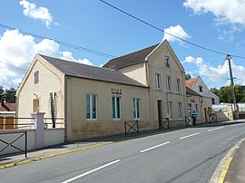 The town hall and school of Saint-Martin-d'Hardinghem | |
 Coat of arms | |
show Location of Saint-Martin-d’Hardinghem | |
 Saint-Martin-d’Hardinghem | |
| Coordinates: 50°36′18″N 2°05′45″E / 50.605°N 2.0958°ECoordinates: 50°36′18″N 2°05′45″E / 50.605°N 2.0958°E | |
| Country | France |
| Region | Hauts-de-France |
| Department | Pas-de-Calais |
| Arrondissement | Saint-Omer |
| Canton | Fruges |
| Intercommunality | Pays de Saint-Omer |
| Government | |
| • Mayor (2020–2026) | Bertrand Pruvost |
| Area 1 | 6.68 km2 (2.58 sq mi) |
| Population (Jan. 2018)[1] | 282 |
| • Density | 42/km2 (110/sq mi) |
| Time zone | UTC+01:00 (CET) |
| • Summer (DST) | UTC+02:00 (CEST) |
| INSEE/Postal code | 62760 /62560 |
| Elevation | 67–163 m (220–535 ft) (avg. 73 m or 240 ft) |
| 1 French Land Register data, which excludes lakes, ponds, glaciers > 1 km2 (0.386 sq mi or 247 acres) and river estuaries. | |


Saint-Martin-d’Hardinghem (West Flemish: Dardingem; Picard: Saint-Martin-d'Hardinghin) is a commune in the Pas-de-Calais department in the Hauts-de-France region of France.
Geography[]
Saint-Martin-d'Hardinghem is a small suburb of Fauquembergues, 10 miles (16 km) to the southwest of Saint-Omer on the D158 road.
Population[]
| Year | Pop. | ±% p.a. |
|---|---|---|
| 1968 | 275 | — |
| 1975 | 270 | −0.26% |
| 1982 | 273 | +0.16% |
| 1990 | 287 | +0.63% |
| 1999 | 303 | +0.60% |
| 2007 | 312 | +0.37% |
| 2012 | 291 | −1.38% |
| 2017 | 286 | −0.35% |
| Source: INSEE[2] | ||
Places of interest[]
- The church of St.Martin, dating from the thirteenth century.
- The Château d'Hervarre.
See also[]
Communes of the Pas-de-Calais department
References[]
- ^ "Populations légales 2018". INSEE. 28 December 2020.
- ^ Population en historique depuis 1968, INSEE
| Wikimedia Commons has media related to Saint-Martin-d'Hardinghem. |
| show Authority control |
|---|
This Pas-de-Calais geographical article is a stub. You can help Wikipedia by . |
Categories:
- Communes of Pas-de-Calais
- Pas-de-Calais geography stubs