Béalencourt
From Wikipedia, the free encyclopedia
Commune in Hauts-de-France, France
Béalencourt | |
|---|---|
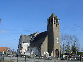 The church of Béalencourt | |
 Coat of arms | |
 Béalencourt  Béalencourt | |
Coordinates:  50°26′07″N 2°07′20″E / 50.4353°N 2.1222°E / 50.4353; 2.1222Coordinates: 50°26′07″N 2°07′20″E / 50.4353°N 2.1222°E / 50.4353; 2.1222 50°26′07″N 2°07′20″E / 50.4353°N 2.1222°E / 50.4353; 2.1222Coordinates: 50°26′07″N 2°07′20″E / 50.4353°N 2.1222°E / 50.4353; 2.1222 | |
| Country | France |
| Region | Hauts-de-France |
| Department | Pas-de-Calais |
| Arrondissement | Montreuil |
| Canton | Auxi-le-Château |
| Intercommunality | Communauté de communes des Sept Vallées |
| Government | |
| • Mayor (2020–2026) | Benoît Théret |
| Area 1 | 7.31 km2 (2.82 sq mi) |
| Population (Jan. 2018)[1] | 131 |
| • Density | 18/km2 (46/sq mi) |
| Time zone | UTC+01:00 (CET) |
| • Summer (DST) | UTC+02:00 (CEST) |
| INSEE/Postal code | 62090 /62770 |
| Elevation | 55–124 m (180–407 ft) (avg. 106 m or 348 ft) |
| 1 French Land Register data, which excludes lakes, ponds, glaciers > 1 km2 (0.386 sq mi or 247 acres) and river estuaries. | |

Béalencourt (French pronunciation: [bealɑ̃kuʁ]) is a commune in the Pas-de-Calais department in the Hauts-de-France region in northern France.
Contents
Geography[]
A small village situated some 16 miles (26 km) east of Montreuil-sur-Mer, on the D107E road.
Population[]
| Year | Pop. | ±% |
|---|---|---|
| 1962 | 164 | — |
| 1968 | 185 | +12.8% |
| 1975 | 157 | −15.1% |
| 1982 | 193 | +22.9% |
| 1990 | 159 | −17.6% |
| 1999 | 135 | −15.1% |
| 2006 | 119 | −11.9% |
| 2007 | 117 | −1.7% |
| 2008 | 115 | −1.7% |
| 2009 | 114 | −0.9% |
| 2013 | 126 | +10.5% |
| 2015 | 128 | +1.6% |
See also[]
References[]
- ^ "Populations légales 2018". INSEE. 28 December 2020.
| Wikimedia Commons has media related to Béalencourt. |
show
Communes of the Pas-de-Calais department | |
|---|---|
|
This Arras arrondissement, Pas-de-Calais geographical article is a stub. You can help Wikipedia by . |
- v
- t
Retrieved from ""
Categories:
- Communes of Pas-de-Calais
- Arras arrondissement geography stubs
Hidden categories:
- Articles with short description
- Short description is different from Wikidata
- Coordinates on Wikidata
- Pages using infobox settlement with image map1 but not image map
- Commons category link is on Wikidata
- Articles with BNF identifiers
- All stub articles
- Pages using the Kartographer extension