Bénifontaine
This article includes a list of references, related reading or external links, but its sources remain unclear because it lacks inline citations. (January 2010) |
Bénifontaine | |
|---|---|
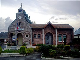 The town hall of Bénifontaine | |
 Coat of arms | |
show Location of Bénifontaine | |
 Bénifontaine | |
| Coordinates: 50°29′16″N 2°49′52″E / 50.4878°N 2.8311°ECoordinates: 50°29′16″N 2°49′52″E / 50.4878°N 2.8311°E | |
| Country | France |
| Region | Hauts-de-France |
| Department | Pas-de-Calais |
| Arrondissement | Lens |
| Canton | Wingles |
| Intercommunality | Communaupole de Lens-Liévin |
| Government | |
| • Mayor (2014-2020) | Jacques Jakuboszczak |
| Area 1 | 4.84 km2 (1.87 sq mi) |
| Population (Jan. 2018)[1] | 355 |
| • Density | 73/km2 (190/sq mi) |
| Time zone | UTC+01:00 (CET) |
| • Summer (DST) | UTC+02:00 (CEST) |
| INSEE/Postal code | 62107 /62410 |
| Elevation | 22–54 m (72–177 ft) (avg. 25 m or 82 ft) |
| 1 French Land Register data, which excludes lakes, ponds, glaciers > 1 km2 (0.386 sq mi or 247 acres) and river estuaries. | |


Bénifontaine is a commune in the Pas-de-Calais department in the Hauts-de-France region in northern France.
Geography[]
A farming village situated just 4 miles (6.4 km) north of Lens at the junction of the N47 and D39 roads.
The airport of Lens-Bénifontaine (code LFQL) is located in the commune.
History[]
The commune owes its name to the quality of the local water, which is used for brewing the regional Ch'Ti beer. During World War I, the village, along with many others, was completely destroyed.
Population[]
| Year | Pop. | ±% |
|---|---|---|
| 1962 | 258 | — |
| 1968 | 275 | +6.6% |
| 1975 | 289 | +5.1% |
| 1982 | 295 | +2.1% |
| 1990 | 303 | +2.7% |
| 1999 | 275 | −9.2% |
| 2005 | 278 | +1.1% |
| 2006 | 297 | +6.8% |
| 2009 | 325 | +9.4% |
| 2011 | 355 | +9.2% |
| 2015 | 359 | +1.1% |
Sights[]
- The Castelain Ch’ti brewery.
- The aerodrome.
See also[]
References[]
- ^ "Populations légales 2018". INSEE. 28 December 2020.
External links[]
| Wikimedia Commons has media related to Bénifontaine. |
- Website of the Communaupole de Lens-Liévin (in French)
- Aéroclub de Lens (in French)
- Castelain Brewery website (in French)
This Pas-de-Calais geographical article is a stub. You can help Wikipedia by . |
Categories:
- Communes of Pas-de-Calais
- Pas-de-Calais geography stubs