Sains-lès-Pernes
Sains-lès-Pernes | |
|---|---|
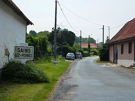 The road into of Sains-lès-Pernes | |
 Coat of arms | |
show Location of Sains-lès-Pernes | |
 Sains-lès-Pernes | |
| Coordinates: 50°28′42″N 2°21′26″E / 50.4783°N 2.3572°ECoordinates: 50°28′42″N 2°21′26″E / 50.4783°N 2.3572°E | |
| Country | France |
| Region | Hauts-de-France |
| Department | Pas-de-Calais |
| Arrondissement | Arras |
| Canton | Saint-Pol-sur-Ternoise |
| Intercommunality | CC Ternois |
| Government | |
| • Mayor (2020–2026) | Jean-Paul Hermant[1] |
| Area 1 | 4.2 km2 (1.6 sq mi) |
| Population (Jan. 2018)[2] | 300 |
| • Density | 71/km2 (180/sq mi) |
| Time zone | UTC+01:00 (CET) |
| • Summer (DST) | UTC+02:00 (CEST) |
| INSEE/Postal code | 62740 /62550 |
| Elevation | 111–186 m (364–610 ft) (avg. 165 m or 541 ft) |
| 1 French Land Register data, which excludes lakes, ponds, glaciers > 1 km2 (0.386 sq mi or 247 acres) and river estuaries. | |


Sains-lès-Pernes is a commune in the Pas-de-Calais department in the Hauts-de-France region of France.
Geography[]
Sains-lès-Pernes is at the junction of the D70 and D71 roads, some 27 miles (43 km) northwest of Arras, close to the town of Pernes. It is the source of the river Clarence, at a place known as "Le Buich".
Population[]
| Year | 1962 | 1968 | 1975 | 1982 | 1990 | 1999 | 2006 |
|---|---|---|---|---|---|---|---|
| Population | 247 | 271 | 262 | 250 | 221 | 209 | 252 |
| From the year 1962 on: No double counting—residents of multiple communes (e.g. students and military personnel) are counted only once. | |||||||
Places of interest[]
- The church of St. Berthe, dating from the sixteenth century.
See also[]
References[]
- ^ "Répertoire national des élus: les maires". data.gouv.fr, Plateforme ouverte des données publiques françaises (in French). 2 December 2020.
- ^ "Populations légales 2018". INSEE. 28 December 2020.
| Wikimedia Commons has media related to Sains-lès-Pernes. |
This Arras arrondissement, Pas-de-Calais geographical article is a stub. You can help Wikipedia by . |
Categories:
- Communes of Pas-de-Calais
- Arras arrondissement geography stubs