Lépine, Pas-de-Calais
Lépine | |
|---|---|
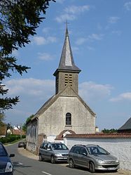 The church of Lépine | |
 Coat of arms | |
Location of Lépine  | |
 Lépine | |
| Coordinates: 50°22′43″N 1°43′37″E / 50.3786°N 1.7269°ECoordinates: 50°22′43″N 1°43′37″E / 50.3786°N 1.7269°E | |
| Country | France |
| Region | Hauts-de-France |
| Department | Pas-de-Calais |
| Arrondissement | Montreuil |
| Canton | Berck |
| Intercommunality | CA Deux Baies en Montreuillois |
| Government | |
| • Mayor (2020–2026) | Benoit Rouzé |
| Area 1 | 10.82 km2 (4.18 sq mi) |
| Population (Jan. 2018)[1] | 280 |
| • Density | 26/km2 (67/sq mi) |
| Time zone | UTC+01:00 (CET) |
| • Summer (DST) | UTC+02:00 (CEST) |
| INSEE/Postal code | 62499 /62170 |
| Elevation | 3–59 m (9.8–193.6 ft) (avg. 46 m or 151 ft) |
| 1 French Land Register data, which excludes lakes, ponds, glaciers > 1 km2 (0.386 sq mi or 247 acres) and river estuaries. | |


Lépine (French pronunciation: [lepin]) is a commune in the Pas-de-Calais department in the Hauts-de-France region of France.[2]
Geography[]
Lépine is situated 6 miles (9 km) south of Montreuil-sur-Mer, just off the N1 on the D140 road.
Population[]
| Year | Pop. | ±% p.a. |
|---|---|---|
| 1968 | 319 | — |
| 1975 | 268 | −2.46% |
| 1982 | 279 | +0.58% |
| 1990 | 296 | +0.74% |
| 1999 | 297 | +0.04% |
| 2007 | 282 | −0.65% |
| 2012 | 278 | −0.29% |
| 2017 | 273 | −0.36% |
| Source: INSEE[3] | ||
Places of interest[]
- The fifteenth century church of the Nativité-de-Notre-Dame.
- Château du Puits-Bérault, dating from the nineteenth century.

The farrier's yard at Puits-Bérault, around 1905.
See also[]
References[]
- ^ "Populations légales 2018". The National Institute of Statistics and Economic Studies. 28 December 2020.
- ^ Commune de Lépine (62499), INSEE
- ^ Population en historique depuis 1968, INSEE
| Wikimedia Commons has media related to Lépine (Pas-de-Calais). |
This Pas-de-Calais geographical article is a stub. You can help Wikipedia by . |
Categories:
- Communes of Pas-de-Calais
- Pas-de-Calais geography stubs