Louches
From Wikipedia, the free encyclopedia
Commune in Hauts-de-France, France
Louches | |
|---|---|
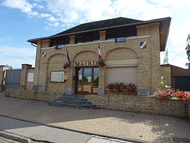 The town hall of Louches | |
 Louches  Louches | |
Coordinates:  50°49′50″N 2°00′26″E / 50.8306°N 2.0072°E / 50.8306; 2.0072Coordinates: 50°49′50″N 2°00′26″E / 50.8306°N 2.0072°E / 50.8306; 2.0072 50°49′50″N 2°00′26″E / 50.8306°N 2.0072°E / 50.8306; 2.0072Coordinates: 50°49′50″N 2°00′26″E / 50.8306°N 2.0072°E / 50.8306; 2.0072 | |
| Country | France |
| Region | Hauts-de-France |
| Department | Pas-de-Calais |
| Arrondissement | Calais |
| Canton | Calais-2 |
| Intercommunality | CC Pays d'Opale |
| Government | |
| • Mayor (2020–2026) | Franck Delabasserue |
| Area 1 | 12.83 km2 (4.95 sq mi) |
| Population (Jan. 2018)[1] | 955 |
| • Density | 74/km2 (190/sq mi) |
| Time zone | UTC+01:00 (CET) |
| • Summer (DST) | UTC+02:00 (CEST) |
| INSEE/Postal code | 62531 /62610 |
| Elevation | 8–166 m (26–545 ft) (avg. 26 m or 85 ft) |
| 1 French Land Register data, which excludes lakes, ponds, glaciers > 1 km2 (0.386 sq mi or 247 acres) and river estuaries. | |

Louches is a commune in the Pas-de-Calais department in the Hauts-de-France region of France.
Geography[]
A village some 12 miles (19 km) southeast of Calais, on the D225 road.
Population[]
| Year | Pop. | ±% p.a. |
|---|---|---|
| 1968 | 696 | — |
| 1975 | 701 | +0.10% |
| 1982 | 677 | −0.50% |
| 1990 | 722 | +0.81% |
| 1999 | 733 | +0.17% |
| 2007 | 853 | +1.91% |
| 2012 | 943 | +2.03% |
| 2017 | 960 | +0.36% |
| Source: INSEE[2] | ||
Places of interest[]
- The church of St.Omer, dating from the seventeenth century.
See also[]
References[]
- ^ "Populations légales 2018". INSEE. 28 December 2020.
- ^ Population en historique depuis 1968, INSEE
| Wikimedia Commons has media related to Louches. |
show
Communes of the Pas-de-Calais department | |
|---|---|
|
This Pas-de-Calais geographical article is a stub. You can help Wikipedia by . |
- v
- t
Retrieved from ""
Categories:
- Communes of Pas-de-Calais
- Pas-de-Calais geography stubs
Hidden categories:
- Articles with short description
- Short description is different from Wikidata
- Coordinates on Wikidata
- Pages using infobox settlement with image map1 but not image map
- Commons category link from Wikidata
- Articles with BNF identifiers
- All stub articles
- Pages using the Kartographer extension