Sauchy-Lestrée
Sauchy-Lestrée | |
|---|---|
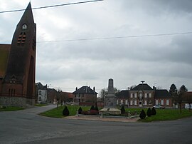 The main square of Sauchy-Lestrée | |
 Coat of arms | |
show Location of Sauchy-Lestrée | |
 Sauchy-Lestrée | |
| Coordinates: 50°13′40″N 3°06′15″E / 50.2278°N 3.1042°ECoordinates: 50°13′40″N 3°06′15″E / 50.2278°N 3.1042°E | |
| Country | France |
| Region | Hauts-de-France |
| Department | Pas-de-Calais |
| Arrondissement | Arras |
| Canton | Bapaume |
| Intercommunality | CC Osartis Marquion |
| Government | |
| • Mayor (2020–2026) | Francis Rigaut[1] |
| Area 1 | 9.06 km2 (3.50 sq mi) |
| Population (Jan. 2018)[2] | 457 |
| • Density | 50/km2 (130/sq mi) |
| Time zone | UTC+01:00 (CET) |
| • Summer (DST) | UTC+02:00 (CEST) |
| INSEE/Postal code | 62781 /62860 |
| Elevation | 41–77 m (135–253 ft) (avg. 47 m or 154 ft) |
| 1 French Land Register data, which excludes lakes, ponds, glaciers > 1 km2 (0.386 sq mi or 247 acres) and river estuaries. | |


Sauchy-Lestrée is a commune in the Pas-de-Calais department in the Hauts-de-France region of France.
Geography[]
Sauchy-Lestrée lies 19 miles (30.6 km) southeast of Arras, at the junction of the D21E and D15 roads.
Population[]
| Year | Pop. | ±% p.a. |
|---|---|---|
| 1968 | 588 | — |
| 1975 | 617 | +0.69% |
| 1982 | 543 | −1.81% |
| 1990 | 458 | −2.11% |
| 1999 | 446 | −0.29% |
| 2007 | 452 | +0.17% |
| 2012 | 445 | −0.31% |
| 2017 | 455 | +0.45% |
| Source: INSEE[3] | ||
Places of interest[]
- The church of St Ambert, rebuilt, as was much of the village, after World War I.
- The Commonwealth War Graves Commission cemetery.
See also[]
Communes of the Pas-de-Calais department
References[]
- ^ "Répertoire national des élus: les maires". data.gouv.fr, Plateforme ouverte des données publiques françaises (in French). 2 December 2020.
- ^ "Populations légales 2018". INSEE. 28 December 2020.
- ^ Population en historique depuis 1968, INSEE
External links[]
| Wikimedia Commons has media related to Sauchy-Lestrée. |
This Arras arrondissement, Pas-de-Calais geographical article is a stub. You can help Wikipedia by . |
Categories:
- Communes of Pas-de-Calais
- Arras arrondissement geography stubs