Frémicourt
Frémicourt | |
|---|---|
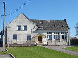 The town hall of Frémicourt | |
 Coat of arms | |
show Location of Frémicourt | |
 Frémicourt | |
| Coordinates: 50°06′42″N 2°54′11″E / 50.1117°N 2.9031°ECoordinates: 50°06′42″N 2°54′11″E / 50.1117°N 2.9031°E | |
| Country | France |
| Region | Hauts-de-France |
| Department | Pas-de-Calais |
| Arrondissement | Arras |
| Canton | Bapaume |
| Intercommunality | CC Sud-Artois |
| Government | |
| • Mayor (2020–2026) | Daniel Tabary[1] |
| Area 1 | 5.63 km2 (2.17 sq mi) |
| Population (Jan. 2018)[2] | 240 |
| • Density | 43/km2 (110/sq mi) |
| Time zone | UTC+01:00 (CET) |
| • Summer (DST) | UTC+02:00 (CEST) |
| INSEE/Postal code | 62353 /62450 |
| Elevation | 98–127 m (322–417 ft) (avg. 115 m or 377 ft) |
| 1 French Land Register data, which excludes lakes, ponds, glaciers > 1 km2 (0.386 sq mi or 247 acres) and river estuaries. | |


Frémicourt is a commune in the Pas-de-Calais department in the Hauts-de-France region of France.
Geography[]
A farming village situated 15 miles (24.1 km) south-southeast of Arras, at the junction of the N30 and the D7E roads.
Population[]
| Year | 1962 | 1968 | 1975 | 1982 | 1990 | 1999 |
|---|---|---|---|---|---|---|
| Population | 299 | 301 | 260 | 219 | 253 | 285 |
| From the year 1962 on: No double counting—residents of multiple communes (e.g. students and military personnel) are counted only once. | ||||||
Places of interest[]
- The church of St. Armand, rebuilt as was the rest of the village, after World War I.
See also[]
- Communes of the Pas-de-Calais department
- Cecil Sewell Victoria Cross recipient after WW1 action near Frémicourt
References[]
- ^ "Répertoire national des élus: les maires". data.gouv.fr, Plateforme ouverte des données publiques françaises (in French). 2 December 2020.
- ^ "Populations légales 2018". INSEE. 28 December 2020.
| Wikimedia Commons has media related to Frémicourt. |
This Arras arrondissement, Pas-de-Calais geographical article is a stub. You can help Wikipedia by . |
Categories:
- Communes of Pas-de-Calais
- Arras arrondissement geography stubs