Blangerval-Blangermont
From Wikipedia, the free encyclopedia
Commune in Hauts-de-France, France
Blangerval-Blangermont | |
|---|---|
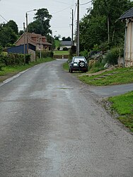 The main road of Blangerval-Blangermont | |
 Coat of arms | |
 Blangerval-Blangermont  Blangerval-Blangermont | |
Coordinates:  50°19′27″N 2°13′56″E / 50.3242°N 2.2322°E / 50.3242; 2.2322Coordinates: 50°19′27″N 2°13′56″E / 50.3242°N 2.2322°E / 50.3242; 2.2322 50°19′27″N 2°13′56″E / 50.3242°N 2.2322°E / 50.3242; 2.2322Coordinates: 50°19′27″N 2°13′56″E / 50.3242°N 2.2322°E / 50.3242; 2.2322 | |
| Country | France |
| Region | Hauts-de-France |
| Department | Pas-de-Calais |
| Arrondissement | Arras |
| Canton | Saint-Pol-sur-Ternoise |
| Intercommunality | Communauté de communes du Ternois |
| Government | |
| • Mayor (2014-2020) | Patrick Truffier |
| Area 1 | 4.61 km2 (1.78 sq mi) |
| Population (Jan. 2018)[1] | 101 |
| • Density | 22/km2 (57/sq mi) |
| Time zone | UTC+01:00 (CET) |
| • Summer (DST) | UTC+02:00 (CEST) |
| INSEE/Postal code | 62137 /62270 |
| Elevation | 72–132 m (236–433 ft) (avg. 95 m or 312 ft) |
| 1 French Land Register data, which excludes lakes, ponds, glaciers > 1 km2 (0.386 sq mi or 247 acres) and river estuaries. | |

Blangerval-Blangermont is a commune in the Pas-de-Calais department in the Hauts-de-France region in northern France.
Geography[]
A farming village located 25 miles (40 km) west of Arras on the D109 road.
Population[]
| Year | Pop. | ±% |
|---|---|---|
| 1962 | 154 | — |
| 1968 | 154 | +0.0% |
| 1975 | 109 | −29.2% |
| 1982 | 107 | −1.8% |
| 1990 | 102 | −4.7% |
| 1999 | 85 | −16.7% |
| 2006 | 91 | +7.1% |
| 2007 | 92 | +1.1% |
| 2008 | 93 | +1.1% |
| 2009 | 95 | +2.2% |
| 2013 | 107 | +12.6% |
| 2015 | 117 | +9.3% |
Sights[]
- The church of St. Pierre, dating from the twentieth century.
- The church of St. Jacques, dating from the eighteenth century.
See also[]
References[]
- ^ "Populations légales 2018". INSEE. 28 December 2020.
| Wikimedia Commons has media related to Blangerval-Blangermont. |
show
Communes of the Pas-de-Calais department | |
|---|---|
|
This Arras arrondissement, Pas-de-Calais geographical article is a stub. You can help Wikipedia by . |
- v
- t
Retrieved from ""
Categories:
- Communes of Pas-de-Calais
- Arras arrondissement geography stubs
Hidden categories:
- Articles with short description
- Short description is different from Wikidata
- Coordinates on Wikidata
- Pages using infobox settlement with image map1 but not image map
- Commons category link is on Wikidata
- Articles with BNF identifiers
- All stub articles
- Pages using the Kartographer extension