Fiennes, Pas-de-Calais
From Wikipedia, the free encyclopedia
Commune in Hauts-de-France, France
Fiennes | |
|---|---|
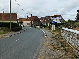 The entrance to the commune | |
 Coat of arms | |
 Fiennes  Fiennes | |
Coordinates:  50°49′38″N 1°49′33″E / 50.8272°N 1.8258°E / 50.8272; 1.8258Coordinates: 50°49′38″N 1°49′33″E / 50.8272°N 1.8258°E / 50.8272; 1.8258 50°49′38″N 1°49′33″E / 50.8272°N 1.8258°E / 50.8272; 1.8258Coordinates: 50°49′38″N 1°49′33″E / 50.8272°N 1.8258°E / 50.8272; 1.8258 | |
| Country | France |
| Region | Hauts-de-France |
| Department | Pas-de-Calais |
| Arrondissement | Calais |
| Canton | Calais-2 |
| Intercommunality | CC Pays d'Opale |
| Government | |
| • Mayor (2008–2014) | Clotilde Roberval |
| Area 1 | 11.64 km2 (4.49 sq mi) |
| Population (Jan. 2018)[1] | 879 |
| • Density | 76/km2 (200/sq mi) |
| Time zone | UTC+01:00 (CET) |
| • Summer (DST) | UTC+02:00 (CEST) |
| INSEE/Postal code | 62334 /62132 |
| Elevation | 71–166 m (233–545 ft) (avg. 92 m or 302 ft) |
| 1 French Land Register data, which excludes lakes, ponds, glaciers > 1 km2 (0.386 sq mi or 247 acres) and river estuaries. | |

Fiennes (French pronunciation: [fjɛn]) is a commune in the Pas-de-Calais department in the Hauts-de-France region of France.
Geography[]
A farming village located 16 km (10 miles) south of Calais, at the junction of the D250, D232 and D151 roads.
Population[]
| Year | 1962 | 1968 | 1975 | 1982 | 1990 | 1999 |
|---|---|---|---|---|---|---|
| Population | 710 | 747 | 682 | 739 | 760 | 813 |
| From the year 1962 on: No double counting—residents of multiple communes (e.g. students and military personnel) are counted only once. | ||||||
Places of interest[]
- The church of St. Martin, dating from the fifteenth century.
- The ruins of a castle, originally destroyed in 1320, rebuilt and destroyed again in 1543
See also[]
References[]
- ^ "Populations légales 2018". INSEE. 28 December 2020.
| Wikimedia Commons has media related to Fiennes. |
show
Communes of the Pas-de-Calais department | |
|---|---|
|
This Pas-de-Calais geographical article is a stub. You can help Wikipedia by . |
- v
- t
Retrieved from ""
Categories:
- Communes of Pas-de-Calais
- Pas-de-Calais geography stubs
Hidden categories:
- Articles with short description
- Short description is different from Wikidata
- Coordinates on Wikidata
- Pages using infobox settlement with image map1 but not image map
- Commons category link is on Wikidata
- Articles with BNF identifiers
- All stub articles
- Pages using the Kartographer extension