Tilloy-lès-Mofflaines
Tilloy-lès-Mofflaines | |
|---|---|
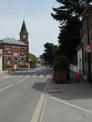 The centre of Tilloy-lès-Mofflaines | |
 Coat of arms | |
Location of Tilloy-lès-Mofflaines  | |
 Tilloy-lès-Mofflaines  Tilloy-lès-Mofflaines | |
| Coordinates: 50°16′38″N 2°49′02″E / 50.2772°N 2.8172°ECoordinates: 50°16′38″N 2°49′02″E / 50.2772°N 2.8172°E | |
| Country | France |
| Region | Hauts-de-France |
| Department | Pas-de-Calais |
| Arrondissement | Arras |
| Canton | Arras-3 |
| Intercommunality | Arras |
| Government | |
| • Mayor (2020–2026) | Didier Michel[1] |
| Area 1 | 7.69 km2 (2.97 sq mi) |
| Population (Jan. 2018)[2] | 1,413 |
| • Density | 180/km2 (480/sq mi) |
| Time zone | UTC+01:00 (CET) |
| • Summer (DST) | UTC+02:00 (CEST) |
| INSEE/Postal code | 62817 /62217 |
| Elevation | 54–102 m (177–335 ft) (avg. 84 m or 276 ft) |
| 1 French Land Register data, which excludes lakes, ponds, glaciers > 1 km2 (0.386 sq mi or 247 acres) and river estuaries. | |
Tilloy-lès-Mofflaines is a commune in the Pas-de-Calais department in the Hauts-de-France region of France.
Geography[]
Tilloy-lès-Mofflaines lies on the south-eastern side of Arras, at the junction of the N39, D34 and D60 roads.
Population[]
| Year | Pop. | ±% p.a. |
|---|---|---|
| 1968 | 773 | — |
| 1975 | 744 | −0.54% |
| 1982 | 806 | +1.15% |
| 1990 | 1,309 | +6.25% |
| 1999 | 1,329 | +0.17% |
| 2007 | 1,380 | +0.47% |
| 2012 | 1,424 | +0.63% |
| 2017 | 1,434 | +0.14% |
| Source: INSEE[3] | ||
Places of interest[]
- The church of St.Brice, rebuilt, along with the rest of the village after the First World War.
- The Commonwealth War Graves Commission cemetery.
See also[]
References[]
- ^ "Répertoire national des élus: les maires". data.gouv.fr, Plateforme ouverte des données publiques françaises (in French). 2 December 2020. Retrieved 7 December 2020.
- ^ "Populations légales 2018". INSEE. 28 December 2020.
- ^ Population en historique depuis 1968, INSEE
External links[]
| Wikimedia Commons has media related to Tilloy-lès-Mofflaines. |
| Authority control |
|
|---|
This Arras arrondissement, Pas-de-Calais geographical article is a stub. You can help Wikipedia by . |
Categories:
- Communes of Pas-de-Calais
- Arras arrondissement geography stubs