Escœuilles
Escœuilles
Skole | |
|---|---|
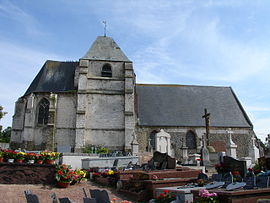 The church in Escœuilles | |
 Coat of arms | |
Location of Escœuilles  | |
 Escœuilles | |
| Coordinates: 50°43′35″N 1°55′38″E / 50.7264°N 1.9272°ECoordinates: 50°43′35″N 1°55′38″E / 50.7264°N 1.9272°E | |
| Country | France |
| Region | Hauts-de-France |
| Department | Pas-de-Calais |
| Arrondissement | Saint-Omer |
| Canton | Lumbres |
| Intercommunality | Pays de Lumbres |
| Government | |
| • Mayor (2020–2026) | Christian Leroy |
| Area 1 | 5.91 km2 (2.28 sq mi) |
| Population (Jan. 2018)[1] | 479 |
| • Density | 81/km2 (210/sq mi) |
| Time zone | UTC+01:00 (CET) |
| • Summer (DST) | UTC+02:00 (CEST) |
| INSEE/Postal code | 62308 /62850 |
| Elevation | 93–211 m (305–692 ft) (avg. 107 m or 351 ft) |
| 1 French Land Register data, which excludes lakes, ponds, glaciers > 1 km2 (0.386 sq mi or 247 acres) and river estuaries. | |


Escœuilles (or Escoeuilles; West Flemish: Skole) is a commune in the Pas-de-Calais department in the Hauts-de-France region of France.
Geography[]
A farming village situated 15 miles (24 km) west of Saint-Omer, at the junction of the N42 and D216 roads.
Etymology[]
The village name first appears in 1084 as Seules. In the year 1200, it had the name Esquelles, then Eskelle, Scules, Escueles, Esquieulles, Ecueil, Escoueuille and finally Escoeuilles.
Population[]
| Year | Pop. | ±% p.a. |
|---|---|---|
| 1968 | 328 | — |
| 1975 | 309 | −0.85% |
| 1982 | 296 | −0.61% |
| 1990 | 331 | +1.41% |
| 1999 | 398 | +2.07% |
| 2007 | 438 | +1.20% |
| 2012 | 464 | +1.16% |
| 2017 | 479 | +0.64% |
| Source: INSEE[2] | ||
Places of interest[]
- The church of the Assumption, dating from the thirteenth century.
- The chapel, built in 1877.
- The war memorial.
See also[]
References[]
- ^ "Populations légales 2018". The National Institute of Statistics and Economic Studies. 28 December 2020.
- ^ Population en historique depuis 1968, INSEE
| Wikimedia Commons has media related to Escœuilles. |
This Pas-de-Calais geographical article is a stub. You can help Wikipedia by . |
Categories:
- Communes of Pas-de-Calais
- Pas-de-Calais geography stubs