Alincthun
Alincthun | |
|---|---|
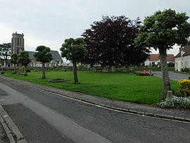 The green in front of the church | |
 Coat of arms | |
show Location of Alincthun | |
 Alincthun | |
| Coordinates: 50°43′55″N 1°48′07″E / 50.7319°N 1.8019°ECoordinates: 50°43′55″N 1°48′07″E / 50.7319°N 1.8019°E | |
| Country | France |
| Region | Hauts-de-France |
| Department | Pas-de-Calais |
| Arrondissement | Boulogne-sur-Mer |
| Canton | Desvres |
| Intercommunality | Desvres-Samer |
| Government | |
| • Mayor (2020–2026) | Jean Picque[1] |
| Area 1 | 9.88 km2 (3.81 sq mi) |
| Population (Jan. 2018)[2] | 322 |
| • Density | 33/km2 (84/sq mi) |
| Time zone | UTC+01:00 (CET) |
| • Summer (DST) | UTC+02:00 (CEST) |
| INSEE/Postal code | 62022 /62142 |
| Elevation | 33–120 m (108–394 ft) (avg. 98 m or 322 ft) |
| 1 French Land Register data, which excludes lakes, ponds, glaciers > 1 km2 (0.386 sq mi or 247 acres) and river estuaries. | |


Alincthun is a commune in the Pas-de-Calais department in the Hauts-de-France region of France.
Geography[]
A small farming commune comprising 12 hamlets, some 10 miles (16 km) east of Boulogne, at the junction of the D238e2 and the D137 roads. The river Liane flows through the village.
Population[]
| Year | Pop. | ±% |
|---|---|---|
| 2005 | 353 | — |
| 2006 | 344 | −2.5% |
| 2007 | 355 | +3.2% |
| 2008 | 349 | −1.7% |
| 2009 | 344 | −1.4% |
| 2010 | 339 | −1.5% |
| 2011 | 340 | +0.3% |
| 2012 | 334 | −1.8% |
| 2013 | 331 | −0.9% |
| 2014 | 329 | −0.6% |
| 2015 | 326 | −0.9% |
| 2016 | 332 | +1.8% |
Sights[]
- The church of St. Denis, dating from the seventeenth century.
- The seventeenth-century Château du Fresnoy.
- Three 17th-century manor houses at La Guilbauderie, Le Fay and Bois-du-Coq.
- A water mill.
See also[]
References[]
- ^ "Répertoire national des élus: les maires". data.gouv.fr, Plateforme ouverte des données publiques françaises (in French). 2 December 2020.
- ^ "Populations légales 2018". INSEE. 28 December 2020.
| Wikimedia Commons has media related to Alincthun. |
This Pas-de-Calais geographical article is a stub. You can help Wikipedia by . |
Categories:
- Communes of Pas-de-Calais
- Pas-de-Calais geography stubs