Anvin
Anvin | |
|---|---|
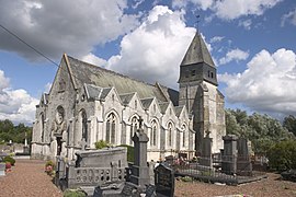 The church of Anvin | |
 Coat of arms | |
show Location of Anvin | |
 Anvin | |
| Coordinates: 50°26′50″N 2°15′22″E / 50.4472°N 2.2561°ECoordinates: 50°26′50″N 2°15′22″E / 50.4472°N 2.2561°E | |
| Country | France |
| Region | Hauts-de-France |
| Department | Pas-de-Calais |
| Arrondissement | Arras |
| Canton | Saint-Pol-sur-Ternoise |
| Intercommunality | Communauté de communes du Ternois |
| Government | |
| • Mayor (2020–2026) | André Olivier[1] |
| Area 1 | 7.83 km2 (3.02 sq mi) |
| Population (Jan. 2018)[2] | 760 |
| • Density | 97/km2 (250/sq mi) |
| Time zone | UTC+01:00 (CET) |
| • Summer (DST) | UTC+02:00 (CEST) |
| INSEE/Postal code | 62036 /62134 |
| Elevation | 51–150 m (167–492 ft) (avg. 60 m or 200 ft) |
| 1 French Land Register data, which excludes lakes, ponds, glaciers > 1 km2 (0.386 sq mi or 247 acres) and river estuaries. | |


Anvin is a commune in the Pas-de-Calais department in northern France.
Geography[]
Anvin is a farming village located in the Ternoise river valley, 28 miles (44 km) northwest of Arras, at the junction of the D343, D70 and D94 roads.
Population[]
The inhabitants are called Anvinois.
| Year | Pop. | ±% |
|---|---|---|
| 1962 | 604 | — |
| 1968 | 615 | +1.8% |
| 1975 | 587 | −4.6% |
| 1982 | 639 | +8.9% |
| 1990 | 666 | +4.2% |
| 1999 | 741 | +11.3% |
| 2005 | 833 | +12.4% |
| 2009 | 803 | −3.6% |
| 2010 | 789 | −1.7% |
| 2015 | 771 | −2.3% |
Sights[]
- The church of St. Leger, dating from the sixteenth century.
- The ruins of a seventeenth-century chateau.
- Vestiges of a watermill.
See also[]
References[]
- ^ "Répertoire national des élus: les maires". data.gouv.fr, Plateforme ouverte des données publiques françaises (in French). 2 December 2020.
- ^ "Populations légales 2018". INSEE. 28 December 2020.
External links[]
| Wikimedia Commons has media related to Anvin. |
This Pas-de-Calais geographical article is a stub. You can help Wikipedia by . |
Categories:
- Communes of Pas-de-Calais
- Pas-de-Calais geography stubs