Avondance
From Wikipedia, the free encyclopedia
Commune in Hauts-de-France, France
Avondance | |
|---|---|
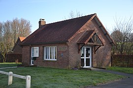 The town hall of Avondance | |
 Coat of arms | |
 Avondance  Avondance | |
Coordinates:  50°28′38″N 2°05′55″E / 50.4772°N 2.0986°E / 50.4772; 2.0986Coordinates: 50°28′38″N 2°05′55″E / 50.4772°N 2.0986°E / 50.4772; 2.0986 50°28′38″N 2°05′55″E / 50.4772°N 2.0986°E / 50.4772; 2.0986Coordinates: 50°28′38″N 2°05′55″E / 50.4772°N 2.0986°E / 50.4772; 2.0986 | |
| Country | France |
| Region | Hauts-de-France |
| Department | Pas-de-Calais |
| Arrondissement | Montreuil |
| Canton | Fruges |
| Intercommunality | Communauté de communes du Haut Pays du Montreuillois |
| Government | |
| • Mayor (2020–2026) | Pierre Desmons[1] |
| Area 1 | 2.19 km2 (0.85 sq mi) |
| Population (Jan. 2018)[2] | 37 |
| • Density | 17/km2 (44/sq mi) |
| Time zone | UTC+01:00 (CET) |
| • Summer (DST) | UTC+02:00 (CEST) |
| INSEE/Postal code | 62066 /62310 |
| Elevation | 100–144 m (328–472 ft) (avg. 129 m or 423 ft) |
| 1 French Land Register data, which excludes lakes, ponds, glaciers > 1 km2 (0.386 sq mi or 247 acres) and river estuaries. | |

Avondance is a commune in the Pas-de-Calais department in northern France.
Geography[]
A tiny village situated some 15 miles (24 km) east of Montreuil-sur-Mer, on the D154 road, the source of the small river Planquette.
Population[]
| Year | Pop. | ±% |
|---|---|---|
| 1962 | 37 | — |
| 1968 | 44 | +18.9% |
| 1975 | 42 | −4.5% |
| 1982 | 36 | −14.3% |
| 1990 | 32 | −11.1% |
| 1999 | 32 | +0.0% |
| 2004 | 33 | +3.1% |
| 2009 | 44 | +33.3% |
| 2014 | 41 | −6.8% |
| 2015 | 40 | −2.4% |
See also[]
References[]
- ^ "Répertoire national des élus: les maires". data.gouv.fr, Plateforme ouverte des données publiques françaises (in French). 2 December 2020.
- ^ "Populations légales 2018". INSEE. 28 December 2020.
External links[]
| Wikimedia Commons has media related to Avondance. |
show
Communes of the Pas-de-Calais department | |
|---|---|
|
This Pas-de-Calais geographical article is a stub. You can help Wikipedia by . |
- v
- t
Retrieved from ""
Categories:
- Communes of Pas-de-Calais
- Pas-de-Calais geography stubs
Hidden categories:
- CS1 French-language sources (fr)
- Articles with short description
- Short description is different from Wikidata
- Coordinates on Wikidata
- Pages using infobox settlement with image map1 but not image map
- Commons category link is on Wikidata
- Articles with BNF identifiers
- All stub articles
- Pages using the Kartographer extension