Balinghem
Balinghem | |
|---|---|
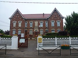 The town hall and school of Balinghem | |
 Coat of arms | |
show Location of Balinghem | |
 Balinghem | |
| Coordinates: 50°51′43″N 1°56′33″E / 50.8619°N 1.9425°ECoordinates: 50°51′43″N 1°56′33″E / 50.8619°N 1.9425°E | |
| Country | France |
| Region | Hauts-de-France |
| Department | Pas-de-Calais |
| Arrondissement | Calais |
| Canton | Calais-2 |
| Intercommunality | Communauté de communes des Pays d'Opale |
| Government | |
| • Mayor (2020–2026) | Jean-Claude Vandenbergue[1] |
| Area 1 | 5.79 km2 (2.24 sq mi) |
| Population (Jan. 2018)[2] | 1,166 |
| • Density | 200/km2 (520/sq mi) |
| Time zone | UTC+01:00 (CET) |
| • Summer (DST) | UTC+02:00 (CEST) |
| INSEE/Postal code | 62078 /62610 |
| Elevation | 2–37 m (6.6–121.4 ft) (avg. 8 m or 26 ft) |
| 1 French Land Register data, which excludes lakes, ponds, glaciers > 1 km2 (0.386 sq mi or 247 acres) and river estuaries. | |


Balinghem (French: [baliŋɡɛm]) is a commune in the Pas-de-Calais department in the Hauts-de-France region in northern France.
Geography[]
A village located 10 miles (16 km) southeast of Calais, on the D228 road.
Population[]
| Year | Pop. | ±% |
|---|---|---|
| 1962 | 511 | — |
| 1968 | 525 | +2.7% |
| 1975 | 539 | +2.7% |
| 1982 | 530 | −1.7% |
| 1990 | 763 | +44.0% |
| 1999 | 829 | +8.7% |
| 2006 | 1,006 | +21.4% |
| 2009 | 1,086 | +8.0% |
| 2011 | 1,165 | +7.3% |
| 2015 | 1,188 | +2.0% |
Sights[]
- The sixteenth-century church of the Nativité-de-Notre-Dame.
- The remains of a château where Henry VIII and Francis I of France met, at the Field of the Cloth of Gold in 1520.
See also[]
References[]
- ^ "Répertoire national des élus: les maires". data.gouv.fr, Plateforme ouverte des données publiques françaises (in French). 2 December 2020.
- ^ "Populations légales 2018". INSEE. 28 December 2020.
External links[]
| Wikimedia Commons has media related to Balinghem. |
- A personal website of the area (in French)
- Official Regional Tourist Office website (in French)
This Pas-de-Calais geographical article is a stub. You can help Wikipedia by . |
Categories:
- Communes of Pas-de-Calais
- Pale of Calais
- Pas-de-Calais geography stubs