Bomy
Bomy | |
|---|---|
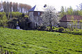
 A typical building of Pas-de-Calais, in Bomy | |
 Coat of arms | |
show Location of Bomy | |
 Bomy | |
| Coordinates: 50°34′29″N 2°14′10″E / 50.5747°N 2.2361°ECoordinates: 50°34′29″N 2°14′10″E / 50.5747°N 2.2361°E | |
| Country | France |
| Region | Hauts-de-France |
| Department | Pas-de-Calais |
| Arrondissement | Saint-Omer |
| Canton | Fruges |
| Intercommunality | Pays de Saint-Omer |
| Government | |
| • Mayor (2020–2026) | Alain Deblock[1] |
| Area 1 | 14.63 km2 (5.65 sq mi) |
| Population (Jan. 2018)[2] | 638 |
| • Density | 44/km2 (110/sq mi) |
| Time zone | UTC+01:00 (CET) |
| • Summer (DST) | UTC+02:00 (CEST) |
| INSEE/Postal code | 62153 /62960 |
| Elevation | 85–180 m (279–591 ft) (avg. 102 m or 335 ft) |
| 1 French Land Register data, which excludes lakes, ponds, glaciers > 1 km2 (0.386 sq mi or 247 acres) and river estuaries. | |


Bomy is a commune in the Pas-de-Calais department in the Hauts-de-France region in northern France.
Geography[]
Bomy is situated 12 miles (19 km) south of the town of Saint-Omer, on the D130 road. It is surrounded by the communes of Beaumetz-lès-Aire, Erny-Saint-Julien and Laires. [3]
Population[]
| Year | Pop. | ±% |
|---|---|---|
| 1962 | 653 | — |
| 1968 | 674 | +3.2% |
| 1975 | 658 | −2.4% |
| 1982 | 603 | −8.4% |
| 1990 | 608 | +0.8% |
| 1999 | 604 | −0.7% |
| 2009 | 596 | −1.3% |
Sights[]
- The church of St. Vaast, dating from the thirteenth century.
- The remains of the old château, where a truce between France and Spain was signed in 1537.
- The present-day château. The building dates from 1755. It was confiscated during the French Revolution and sold for use as a sugar beet factory. It was sold again in 1839 to the Baron de Vilmarest.

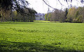
The wooded site of the old château

The main façade of the present building
View of the rear of the château
Weir on the river Locquette


See also[]
References[]
- ^ "Répertoire national des élus: les maires". data.gouv.fr, Plateforme ouverte des données publiques françaises (in French). 2 December 2020.
- ^ "Populations légales 2018". INSEE. 28 December 2020.
- ^ "Annuaire-Mairie"
| Wikimedia Commons has media related to Bomy. |
| show Authority control |
|---|
This Pas-de-Calais geographical article is a stub. You can help Wikipedia by . |
Categories:
- Communes of Pas-de-Calais
- Pas-de-Calais geography stubs