Condette
Condette | |
|---|---|
 The town hall of Condette | |
 Coat of arms | |
show Location of Condette | |
 Condette | |
| Coordinates: 50°39′18″N 1°38′03″E / 50.655°N 1.6342°ECoordinates: 50°39′18″N 1°38′03″E / 50.655°N 1.6342°E | |
| Country | France |
| Region | Hauts-de-France |
| Department | Pas-de-Calais |
| Arrondissement | Boulogne-sur-Mer |
| Canton | Outreau |
| Intercommunality | CA du Boulonnais |
| Government | |
| • Mayor (2008–2014) | Kaddour-Jean Derrar |
| Area 1 | 16.26 km2 (6.28 sq mi) |
| Population (Jan. 2018)[1] | 2,486 |
| • Density | 150/km2 (400/sq mi) |
| Time zone | UTC+01:00 (CET) |
| • Summer (DST) | UTC+02:00 (CEST) |
| INSEE/Postal code | 62235 /62360 |
| Elevation | 6–106 m (20–348 ft) (avg. 35 m or 115 ft) |
| 1 French Land Register data, which excludes lakes, ponds, glaciers > 1 km2 (0.386 sq mi or 247 acres) and river estuaries. | |


Condette is a commune in the Pas-de-Calais department in the Hauts-de-France region of France.
Geography[]
A large farming, forestry and tourist village, some 6 miles (9.7 km) south of Boulogne-sur-Mer, at the junction of the D240 and the D940 roads. The river Liane forms the northeast commune border and the A16 autoroute passes through the commune.
Population[]
| Year | 1962 | 1968 | 1975 | 1982 | 1990 | 1999 |
|---|---|---|---|---|---|---|
| Population | 1420 | 1611 | 1869 | 2084 | 2392 | 2675 |
| From the year 1962 on: No double counting—residents of multiple communes (e.g. students and military personnel) are counted only once. | ||||||
Places of interest[]
- The church of St.Martin, dating from the fifteenth century.
- The neo-Gothic Chateau d’Hardelot, dating from the middle of the nineteenth century.
- The manorhouse of the Grand Moulin.
See also[]
References[]
- ^ "Populations légales 2018". INSEE. 28 December 2020.
External links[]
| Wikimedia Commons has media related to Condette. |
Gallery[]

Chateau d'Hardelot
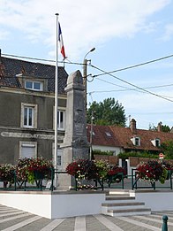
Memorial to the fallen

The reflecting lakes of Condette


| show Authority control |
|---|
This Pas-de-Calais geographical article is a stub. You can help Wikipedia by . |
Categories:
- Communes of Pas-de-Calais
- Pas-de-Calais geography stubs