Essars
Essars | |
|---|---|
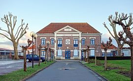 The town hall of Essars | |
 Coat of arms | |
show Location of Essars | |
 Essars | |
| Coordinates: 50°32′52″N 2°39′55″E / 50.5478°N 2.6653°ECoordinates: 50°32′52″N 2°39′55″E / 50.5478°N 2.6653°E | |
| Country | France |
| Region | Hauts-de-France |
| Department | Pas-de-Calais |
| Arrondissement | Béthune |
| Canton | Beuvry |
| Intercommunality | CA Béthune-Bruay, Artois-Lys Romane |
| Government | |
| • Mayor (2020–2026) | Gérard Malbranque[1] |
| Area 1 | 3.72 km2 (1.44 sq mi) |
| Population (Jan. 2018)[2] | 1,742 |
| • Density | 470/km2 (1,200/sq mi) |
| Time zone | UTC+01:00 (CET) |
| • Summer (DST) | UTC+02:00 (CEST) |
| INSEE/Postal code | 62310 /62400 |
| Elevation | 18–23 m (59–75 ft) (avg. 21 m or 69 ft) |
| 1 French Land Register data, which excludes lakes, ponds, glaciers > 1 km2 (0.386 sq mi or 247 acres) and river estuaries. | |


Essars is a commune in the Pas-de-Calais department in the Hauts-de-France region of France.
Geography[]
A farming and boat building village suburb to the northeast of Béthune and 20 miles (32.2 km) southwest of Lille, at the junction of the D171 and the D945 roads. The Canal d’Aire and the Lawe River separate the commune from Bethune.
Population[]
| Year | 1962 | 1968 | 1975 | 1982 | 1990 | 1999 |
|---|---|---|---|---|---|---|
| Population | 901 | 1175 | 1151 | 1683 | 1919 | 1732 |
| From the year 1962 on: No double counting—residents of multiple communes (e.g. students and military personnel) are counted only once. | ||||||
Places of interest[]
- The church of St.Jacques, dating from the twentieth century.
See also[]
References[]
- ^ "Répertoire national des élus: les maires". data.gouv.fr, Plateforme ouverte des données publiques françaises (in French). 2 December 2020.
- ^ "Populations légales 2018". INSEE. 28 December 2020.
| Wikimedia Commons has media related to Essars. |
This Pas-de-Calais geographical article is a stub. You can help Wikipedia by . |
Categories:
- Communes of Pas-de-Calais
- Pas-de-Calais geography stubs