Festubert
Festubert | |
|---|---|
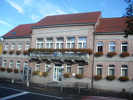 The town hall of Festubert | |
 Coat of arms | |
show Location of Festubert | |
 Festubert | |
| Coordinates: 50°32′39″N 2°44′15″E / 50.5442°N 2.7375°ECoordinates: 50°32′39″N 2°44′15″E / 50.5442°N 2.7375°E | |
| Country | France |
| Region | Hauts-de-France |
| Department | Pas-de-Calais |
| Arrondissement | Béthune |
| Canton | Douvrin |
| Intercommunality | CA Béthune-Bruay, Artois-Lys Romane |
| Government | |
| • Mayor (2020–2026) | Jean-Marie Douvry[1] |
| Area 1 | 7.64 km2 (2.95 sq mi) |
| Population (Jan. 2018)[2] | 1,297 |
| • Density | 170/km2 (440/sq mi) |
| Time zone | UTC+01:00 (CET) |
| • Summer (DST) | UTC+02:00 (CEST) |
| INSEE/Postal code | 62330 /62149 |
| Elevation | 18–21 m (59–69 ft) (avg. 20 m or 66 ft) |
| 1 French Land Register data, which excludes lakes, ponds, glaciers > 1 km2 (0.386 sq mi or 247 acres) and river estuaries. | |


Festubert is a commune in the Pas-de-Calais department in the Hauts-de-France region of France. The village was on the Western Front during the First World War and was largely destroyed in the May 1915 Battle of Festubert.
Geography[]
A farming village some 5 miles (8.0 km) east of Béthune and 21 miles (33.8 km) southwest of Lille, at the junction of the D166 and the D72 roads.
Population[]
| Year | 1962 | 1968 | 1975 | 1982 | 1990 | 1999 |
|---|---|---|---|---|---|---|
| Population | 667 | 679 | 670 | 770 | 1046 | 1120 |
| From the year 1962 on: No double counting—residents of multiple communes (e.g. students and military personnel) are counted only once. | ||||||
Places of interest[]
- The church of Notre-Dame, rebuilt, as was much of the village, after the First World War.
- The Commonwealth War Graves Commission cemeteries.
See also[]
- Communes of the Pas-de-Calais department
- Defence of Festubert (November 1914)
- Battle of Festubert (May 1915)
- Battle of the Lys (1918) (Festubert was on the southern extremity of this battle)
References[]
- ^ "Répertoire national des élus: les maires". data.gouv.fr, Plateforme ouverte des données publiques françaises (in French). 2 December 2020.
- ^ "Populations légales 2018". INSEE. 28 December 2020.
External links[]
| Wikimedia Commons has media related to Festubert. |
| show Authority control |
|---|
This Pas-de-Calais geographical article is a stub. You can help Wikipedia by . |
Categories:
- Communes of Pas-de-Calais
- Pas-de-Calais geography stubs