Fiefs, Pas-de-Calais
Fiefs | |
|---|---|
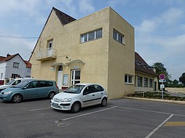 The town hall of Fiefs | |
 Coat of arms | |
show Location of Fiefs | |
 Fiefs | |
| Coordinates: 50°30′16″N 2°19′38″E / 50.5044°N 2.3272°ECoordinates: 50°30′16″N 2°19′38″E / 50.5044°N 2.3272°E | |
| Country | France |
| Region | Hauts-de-France |
| Department | Pas-de-Calais |
| Arrondissement | Arras |
| Canton | Saint-Pol-sur-Ternoise |
| Intercommunality | CC Ternois |
| Government | |
| • Mayor (2020–2026) | René Choquet[1] |
| Area 1 | 10.97 km2 (4.24 sq mi) |
| Population (Jan. 2018)[2] | 385 |
| • Density | 35/km2 (91/sq mi) |
| Time zone | UTC+01:00 (CET) |
| • Summer (DST) | UTC+02:00 (CEST) |
| INSEE/Postal code | 62333 /62134 |
| Elevation | 110–196 m (361–643 ft) (avg. 195 m or 640 ft) |
| 1 French Land Register data, which excludes lakes, ponds, glaciers > 1 km2 (0.386 sq mi or 247 acres) and river estuaries. | |


Fiefs is a commune in the Pas-de-Calais department in the Hauts-de-France region of France.
Geography[]
A farming village situated 26 miles (41.8 km) northwest of Arras, at the junction of the D77 and D92 roads.
Population[]
The inhabitants are called Fieffois.
| Year | 1962 | 1968 | 1975 | 1982 | 1990 | 1999 |
|---|---|---|---|---|---|---|
| Population | 395 | 400 | 366 | 334 | 304 | 329 |
| From the year 1962 on: No double counting—residents of multiple communes (e.g. students and military personnel) are counted only once. | ||||||
Places of interest[]
- The modern church of St. Germain, built in 1957.
See also[]
References[]
- ^ "Répertoire national des élus: les maires". data.gouv.fr, Plateforme ouverte des données publiques françaises (in French). 2 December 2020.
- ^ "Populations légales 2018". INSEE. 28 December 2020.
| Wikimedia Commons has media related to Fiefs. |
This Arras arrondissement, Pas-de-Calais geographical article is a stub. You can help Wikipedia by . |
Categories:
- Communes of Pas-de-Calais
- Arras arrondissement geography stubs