Galametz
From Wikipedia, the free encyclopedia
Commune in Hauts-de-France, France
Galametz | |
|---|---|
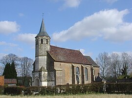 The church of Galametz | |
 Coat of arms | |
 Galametz  Galametz | |
Coordinates:  50°19′45″N 2°08′22″E / 50.3292°N 2.1394°E / 50.3292; 2.1394Coordinates: 50°19′45″N 2°08′22″E / 50.3292°N 2.1394°E / 50.3292; 2.1394 50°19′45″N 2°08′22″E / 50.3292°N 2.1394°E / 50.3292; 2.1394Coordinates: 50°19′45″N 2°08′22″E / 50.3292°N 2.1394°E / 50.3292; 2.1394 | |
| Country | France |
| Region | Hauts-de-France |
| Department | Pas-de-Calais |
| Arrondissement | Montreuil |
| Canton | Auxi-le-Château |
| Intercommunality | CC Sept Vallées |
| Government | |
| • Mayor (2020–2026) | Rene Bienaimé[1] |
| Area 1 | 4.27 km2 (1.65 sq mi) |
| Population (Jan. 2018)[2] | 197 |
| • Density | 46/km2 (120/sq mi) |
| Time zone | UTC+01:00 (CET) |
| • Summer (DST) | UTC+02:00 (CEST) |
| INSEE/Postal code | 62365 /62770 |
| Elevation | 37–131 m (121–430 ft) (avg. 43 m or 141 ft) |
| 1 French Land Register data, which excludes lakes, ponds, glaciers > 1 km2 (0.386 sq mi or 247 acres) and river estuaries. | |

Galametz is a commune in the Pas-de-Calais department in the Hauts-de-France region of France.
Geography[]
A small village situated some 20 miles (32 km) southeast of Montreuil-sur-Mer on the D340 road.
Population[]
| Year | 1962 | 1968 | 1975 | 1982 | 1990 | 1999 |
|---|---|---|---|---|---|---|
| Population | 119 | 131 | 124 | 160 | 148 | 157 |
| From the year 1962 on: No double counting—residents of multiple communes (e.g. students and military personnel) are counted only once. | ||||||
Places of interest[]
- Church of St. Martin, dating from the eighteenth century.
See also[]
References[]
- ^ "Répertoire national des élus: les maires". data.gouv.fr, Plateforme ouverte des données publiques françaises (in French). 2 December 2020. Retrieved 7 December 2020.
- ^ "Populations légales 2018". INSEE. 28 December 2020.
| Wikimedia Commons has media related to Galametz. |
show
Communes of the Pas-de-Calais department | |
|---|---|
|
This Pas-de-Calais geographical article is a stub. You can help Wikipedia by . |
- v
- t
Retrieved from ""
Categories:
- Communes of Pas-de-Calais
- Pas-de-Calais geography stubs
Hidden categories:
- CS1 French-language sources (fr)
- Articles with short description
- Short description is different from Wikidata
- Coordinates on Wikidata
- Pages using infobox settlement with image map1 but not image map
- Commons category link from Wikidata
- Articles with BNF identifiers
- All stub articles
- Pages using the Kartographer extension