Gennes-Ivergny
Gennes-Ivergny | |
|---|---|
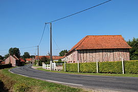 A view within Gennes-Ivergny | |
 Coat of arms | |
show Location of Gennes-Ivergny | |
 Gennes-Ivergny | |
| Coordinates: 50°15′50″N 2°02′52″E / 50.2639°N 2.0478°ECoordinates: 50°15′50″N 2°02′52″E / 50.2639°N 2.0478°E | |
| Country | France |
| Region | Hauts-de-France |
| Department | Pas-de-Calais |
| Arrondissement | Arras |
| Canton | Auxi-le-Château |
| Intercommunality | CC Ternois |
| Government | |
| • Mayor (2008–2014) | Philippe Bocquet |
| Area 1 | 10.98 km2 (4.24 sq mi) |
| Population (Jan. 2018)[1] | 126 |
| • Density | 11/km2 (30/sq mi) |
| Time zone | UTC+01:00 (CET) |
| • Summer (DST) | UTC+02:00 (CEST) |
| INSEE/Postal code | 62370 /62390 |
| Elevation | 22–132 m (72–433 ft) (avg. 91 m or 299 ft) |
| 1 French Land Register data, which excludes lakes, ponds, glaciers > 1 km2 (0.386 sq mi or 247 acres) and river estuaries. | |


Gennes-Ivergny is a commune in the Pas-de-Calais department in the Hauts-de-France region of France.
Geography[]
A small farming village situated on the north bank of the river Authie, the border with the Somme department, 32 miles (51.5 km) west of Arras, at the junction of the D115 and the D124 roads.
Population[]
| Year | 1962 | 1968 | 1975 | 1982 | 1990 | 1999 |
|---|---|---|---|---|---|---|
| Population | 179 | 179 | 177 | 162 | 161 | 141 |
| From the year 1962 on: No double counting—residents of multiple communes (e.g. students and military personnel) are counted only once. | ||||||
Places of interest[]
- The church of St.Louis, dating from the seventeenth century.
- The Commonwealth War Graves Commission cemetery.
- A sixteenth century manor house with a 5-sided tower.
See also[]
References[]
- ^ "Populations légales 2018". INSEE. 28 December 2020.
External links[]
| Wikimedia Commons has media related to Gennes-Ivergny. |
| show Authority control |
|---|
This Arras arrondissement, Pas-de-Calais geographical article is a stub. You can help Wikipedia by . |
Categories:
- Communes of Pas-de-Calais
- Arras arrondissement geography stubs