Gonnehem
Gonnehem | |
|---|---|
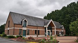 The town hall of Gonnehem | |
 Coat of arms | |
show Location of Gonnehem | |
 Gonnehem | |
| Coordinates: 50°33′44″N 2°34′29″E / 50.5622°N 2.5747°ECoordinates: 50°33′44″N 2°34′29″E / 50.5622°N 2.5747°E | |
| Country | France |
| Region | Hauts-de-France |
| Department | Pas-de-Calais |
| Arrondissement | Béthune |
| Canton | Lillers |
| Intercommunality | CA Béthune-Bruay, Artois-Lys Romane |
| Government | |
| • Mayor (2020–2026) | Bernard Delelis[1] |
| Area 1 | 15.31 km2 (5.91 sq mi) |
| Population (Jan. 2018)[2] | 2,522 |
| • Density | 160/km2 (430/sq mi) |
| Time zone | UTC+01:00 (CET) |
| • Summer (DST) | UTC+02:00 (CEST) |
| INSEE/Postal code | 62376 /62920 |
| Elevation | 17–44 m (56–144 ft) (avg. 20 m or 66 ft) |
| 1 French Land Register data, which excludes lakes, ponds, glaciers > 1 km2 (0.386 sq mi or 247 acres) and river estuaries. | |


Gonnehem is a commune in the Pas-de-Calais department in the Hauts-de-France region of France.
The trumpeter Marc Geujon was born in Gonneheim on 8 October 1974.
Geography[]
A large farming village situated some 5 miles (8.0 km) northwest of Béthune and 22 miles (35.4 km) west of Lille, at the junction of the D181, D182 and the D70 roads.
Population[]
| Year | 1962 | 1968 | 1975 | 1982 | 1990 | 1999 | 2004 |
|---|---|---|---|---|---|---|---|
| Population | 1701 | 1755 | 1740 | 1805 | 2172 | 2141 | 2235 |
| From the year 1962 on: No double counting—residents of multiple communes (e.g. students and military personnel) are counted only once. | |||||||
Places of interest[]
- The fifteenth-century chateau de Werppe.
- The manorhouse de Bron, dating from the fifteenth century.
- The church of St.Pierre, dating from the sixteenth century.
- The church at the hamlet of Busnettes.
See also[]
References[]
- ^ "Répertoire national des élus: les maires". data.gouv.fr, Plateforme ouverte des données publiques françaises (in French). 2 December 2020.
- ^ "Populations légales 2018". INSEE. 28 December 2020.
| Wikimedia Commons has media related to Gonnehem. |
This Pas-de-Calais geographical article is a stub. You can help Wikipedia by . |
Categories:
- Communes of Pas-de-Calais
- Pas-de-Calais geography stubs