Gouy-sous-Bellonne
Gouy-sous-Bellonne | |
|---|---|
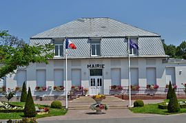 The town hall of Gouy-sous-Bellonne | |
 Coat of arms | |
show Location of Gouy-sous-Bellonne | |
 Gouy-sous-Bellonne | |
| Coordinates: 50°18′43″N 3°03′24″E / 50.3119°N 3.0567°ECoordinates: 50°18′43″N 3°03′24″E / 50.3119°N 3.0567°E | |
| Country | France |
| Region | Hauts-de-France |
| Department | Pas-de-Calais |
| Arrondissement | Arras |
| Canton | Brebières |
| Intercommunality | CC Osartis Marquion |
| Government | |
| • Mayor (2020–2026) | Jean-Marie Hermant[1] |
| Area 1 | 5.47 km2 (2.11 sq mi) |
| Population (Jan. 2018)[2] | 1,373 |
| • Density | 250/km2 (650/sq mi) |
| Time zone | UTC+01:00 (CET) |
| • Summer (DST) | UTC+02:00 (CEST) |
| INSEE/Postal code | 62383 /62112 |
| Elevation | 29–61 m (95–200 ft) (avg. 54 m or 177 ft) |
| 1 French Land Register data, which excludes lakes, ponds, glaciers > 1 km2 (0.386 sq mi or 247 acres) and river estuaries. | |


Gouy-sous-Bellonne is a commune in the Pas-de-Calais department in the Hauts-de-France region of France.
Geography[]
A farming village situated 15 miles (24.1 km) east of Arras, at the junction of the D956 and D45 roads.
Population[]
| Year | 1962 | 1968 | 1975 | 1982 | 1990 | 1999 |
|---|---|---|---|---|---|---|
| Population | 675 | 692 | 873 | 1208 | 1321 | 1258 |
| From the year 1962 on: No double counting—residents of multiple communes (e.g. students and military personnel) are counted only once. | ||||||
Places of interest[]
- The church of St. Georges, rebuilt along with the rest of the village after World War I.

015 Gouy-sous-Bellonne ( 62112 )
See also[]
References[]
- ^ "Répertoire national des élus: les maires". data.gouv.fr, Plateforme ouverte des données publiques françaises (in French). 2 December 2020.
- ^ "Populations légales 2018". INSEE. 28 December 2020.
| Wikimedia Commons has media related to Gouy-sous-Bellonne. |
This Arras arrondissement, Pas-de-Calais geographical article is a stub. You can help Wikipedia by . |
Categories:
- Communes of Pas-de-Calais
- Arras arrondissement geography stubs