Grigny, Pas-de-Calais
Grigny | |
|---|---|
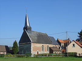 The church of Grigny | |
 Coat of arms | |
show Location of Grigny | |
 Grigny | |
| Coordinates: 50°23′08″N 2°04′02″E / 50.3856°N 2.0672°ECoordinates: 50°23′08″N 2°04′02″E / 50.3856°N 2.0672°E | |
| Country | France |
| Region | Hauts-de-France |
| Department | Pas-de-Calais |
| Arrondissement | Montreuil |
| Canton | Auxi-le-Château |
| Intercommunality | CC Sept Vallées |
| Government | |
| • Mayor (2020–2026) | Francis Maniez[1] |
| Area 1 | 2.14 km2 (0.83 sq mi) |
| Population (Jan. 2018)[2] | 296 |
| • Density | 140/km2 (360/sq mi) |
| Time zone | UTC+01:00 (CET) |
| • Summer (DST) | UTC+02:00 (CEST) |
| INSEE/Postal code | 62388 /62140 |
| Elevation | 25–85 m (82–279 ft) (avg. 31 m or 102 ft) |
| 1 French Land Register data, which excludes lakes, ponds, glaciers > 1 km2 (0.386 sq mi or 247 acres) and river estuaries. | |


Grigny (French pronunciation: [ɡʁiɲi] (![]() listen)) is a commune in the Pas-de-Calais department in the Hauts-de-France region of France.
listen)) is a commune in the Pas-de-Calais department in the Hauts-de-France region of France.
Geography[]
A village situated at the edge of the forest of Hesdin, some 13 miles (21 km) southeast of Montreuil-sur-Mer on the D94E1 road.
Population[]
| Year | 1962 | 1968 | 1975 | 1982 | 1990 | 1999 | 2012 |
|---|---|---|---|---|---|---|---|
| Population | 369 | 383 | 399 | 375 | 361 | 329 | 298 |
| From the year 1962 on: No double counting—residents of multiple communes (e.g. students and military personnel) are counted only once. | |||||||
Places of interest[]
- Church of St. Gertrude, dating from the seventeenth century.
See also[]
References[]
- ^ "Répertoire national des élus: les maires". data.gouv.fr, Plateforme ouverte des données publiques françaises (in French). 2 December 2020. Retrieved 7 December 2020.
- ^ "Populations légales 2018". INSEE. 28 December 2020.
External links[]
| Wikimedia Commons has media related to Grigny (Pas-de-Calais). |
- Grigny on the Insee website (in French)
This Pas-de-Calais geographical article is a stub. You can help Wikipedia by . |
Categories:
- Communes of Pas-de-Calais
- Pas-de-Calais geography stubs