Haisnes
Haisnes | |
|---|---|
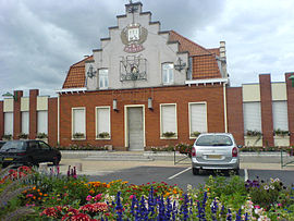 Town hall | |
 Coat of arms | |
show Location of Haisnes | |
 Haisnes | |
| Coordinates: 50°30′31″N 2°48′09″E / 50.5086°N 2.8025°ECoordinates: 50°30′31″N 2°48′09″E / 50.5086°N 2.8025°E | |
| Country | France |
| Region | Hauts-de-France |
| Department | Pas-de-Calais |
| Arrondissement | Béthune |
| Canton | Douvrin |
| Intercommunality | CA Béthune-Bruay, Artois-Lys Romane |
| Government | |
| • Mayor (2020–2026) | Frederic Wallet |
| Area 1 | 5.58 km2 (2.15 sq mi) |
| Population (Jan. 2018)[1] | 4,380 |
| • Density | 780/km2 (2,000/sq mi) |
| Time zone | UTC+01:00 (CET) |
| • Summer (DST) | UTC+02:00 (CEST) |
| INSEE/Postal code | 62401 /62138 |
| Elevation | 22–47 m (72–154 ft) (avg. 26 m or 85 ft) |
| 1 French Land Register data, which excludes lakes, ponds, glaciers > 1 km2 (0.386 sq mi or 247 acres) and river estuaries. | |


Haisnes is a commune in the Pas-de-Calais department in the Hauts-de-France region of France.
Geography[]
Haisnes is a former coalmining town, now a light industrial and farming commune, situated some 9 miles (14.5 km) east of Béthune and 16 miles (25.7 km) southwest of Lille, at the junction of the D163 and the D947 roads.
Population[]
| Year | 1962 | 1968 | 1975 | 1982 | 1990 | 1999 |
|---|---|---|---|---|---|---|
| Population | 2696 | 2709 | 3106 | 3970 | 4525 | 4357 |
| From the year 1962 on: No double counting—residents of multiple communes (e.g. students and military personnel) are counted only once. | ||||||
Places of interest[]

St.Nicaise church
- The churches of St.Nicaise and St. Elie, both dating from the twentieth century.
- The Commonwealth War Graves Commission cemeteries.
See also[]
References[]
- ^ "Populations légales 2018". INSEE. 28 December 2020.
External links[]
| Wikimedia Commons has media related to Haisnes. |
This Pas-de-Calais geographical article is a stub. You can help Wikipedia by . |
Categories:
- Communes of Pas-de-Calais
- Pas-de-Calais geography stubs