Halinghen
Halinghen | |
|---|---|
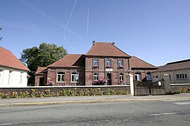 The town hall of Halinghen | |
 Coat of arms | |
show Location of Halinghen | |
 Halinghen | |
| Coordinates: 50°36′11″N 1°41′34″E / 50.6031°N 1.6928°ECoordinates: 50°36′11″N 1°41′34″E / 50.6031°N 1.6928°E | |
| Country | France |
| Region | Hauts-de-France |
| Department | Pas-de-Calais |
| Arrondissement | Boulogne-sur-Mer |
| Canton | Desvres |
| Intercommunality | CC Desvres-Samer |
| Government | |
| • Mayor (2020–2026) | Guy Lambert[1] |
| Area 1 | 5.53 km2 (2.14 sq mi) |
| Population (Jan. 2018)[2] | 319 |
| • Density | 58/km2 (150/sq mi) |
| Time zone | UTC+01:00 (CET) |
| • Summer (DST) | UTC+02:00 (CEST) |
| INSEE/Postal code | 62402 /62830 |
| Elevation | 68–178 m (223–584 ft) (avg. 150 m or 490 ft) |
| 1 French Land Register data, which excludes lakes, ponds, glaciers > 1 km2 (0.386 sq mi or 247 acres) and river estuaries. | |


Halinghen is a commune in the Pas-de-Calais department in the Hauts-de-France region of France.
Geography[]
A small farming village situated some 10 miles (16 km) southeast of Boulogne, at the junction of the D125 and the D239 roads.
Population[]
| Year | 1962 | 1968 | 1975 | 1982 | 1990 | 1999 |
|---|---|---|---|---|---|---|
| Population | 172 | 248 | 252 | 249 | 283 | 279 |
| From the year 1962 on: No double counting—residents of multiple communes (e.g. students and military personnel) are counted only once. | ||||||
Places of interest[]
- The church of St.Sylvestre, dating from the nineteenth century.
See also[]
References[]
- ^ "Répertoire national des élus: les maires". data.gouv.fr, Plateforme ouverte des données publiques françaises (in French). 2 December 2020.
- ^ "Populations légales 2018". INSEE. 28 December 2020.
| Wikimedia Commons has media related to Halinghen. |
This Pas-de-Calais geographical article is a stub. You can help Wikipedia by . |
Categories:
- Communes of Pas-de-Calais
- Pas-de-Calais geography stubs