La Couture, Pas-de-Calais
La Couture
De Kouter | |
|---|---|
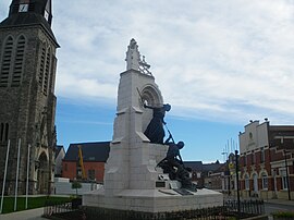 The church, war memorial and town hall of La Couture | |
 Coat of arms | |
show Location of La Couture | |
 La Couture | |
| Coordinates: 50°34′55″N 2°42′46″E / 50.5819°N 2.7128°ECoordinates: 50°34′55″N 2°42′46″E / 50.5819°N 2.7128°E | |
| Country | France |
| Region | Hauts-de-France |
| Department | Pas-de-Calais |
| Arrondissement | Béthune |
| Canton | Beuvry |
| Intercommunality | CA Béthune-Bruay, Artois-Lys Romane |
| Government | |
| • Mayor (2020–2026) | Raymond Gaquère[1] |
| Area 1 | 13.52 km2 (5.22 sq mi) |
| Population (Jan. 2018)[2] | 2,720 |
| • Density | 200/km2 (520/sq mi) |
| Time zone | UTC+01:00 (CET) |
| • Summer (DST) | UTC+02:00 (CEST) |
| INSEE/Postal code | 62252 /62136 |
| Elevation | 15–20 m (49–66 ft) (avg. 18 m or 59 ft) |
| 1 French Land Register data, which excludes lakes, ponds, glaciers > 1 km2 (0.386 sq mi or 247 acres) and river estuaries. | |


La Couture (West Flemish: De Kouter) is a commune in the Pas-de-Calais department in the Hauts-de-France region of France.
Geography[]
A large farming village, situated some 6 miles (9.7 km) northeast of Béthune and 18 miles (29.0 km) west of Lille at the junction of the D169 and the D170 roads.
Population[]
| Year | 1962 | 1968 | 1975 | 1982 | 1990 | 1999 |
|---|---|---|---|---|---|---|
| Population | 1303 | 1327 | 1332 | 1666 | 2165 | 2249 |
| From the year 1962 on: No double counting—residents of multiple communes (e.g. students and military personnel) are counted only once. | ||||||
Places of interest[]
- The church of St. Pierre, rebuilt along with the rest of the village. after World War I.
- The memorial to Portuguese soldiers of 1914–18.
See also[]
References[]
- ^ "Répertoire national des élus: les maires". data.gouv.fr, Plateforme ouverte des données publiques françaises (in French). 2 December 2020.
- ^ "Populations légales 2018". INSEE. 28 December 2020.
| Wikimedia Commons has media related to La Couture (Pas-de-Calais). |
This Pas-de-Calais geographical article is a stub. You can help Wikipedia by . |
Categories:
- Communes of Pas-de-Calais
- Pas-de-Calais geography stubs