Landrethun-le-Nord
Landrethun-le-Nord
Landerten | |
|---|---|
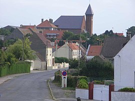 A general view of Landrethun-le-Nord | |
 Coat of arms | |
show Location of Landrethun-le-Nord | |
 Landrethun-le-Nord | |
| Coordinates: 50°50′53″N 1°47′05″E / 50.8481°N 1.7847°ECoordinates: 50°50′53″N 1°47′05″E / 50.8481°N 1.7847°E | |
| Country | France |
| Region | Hauts-de-France |
| Department | Pas-de-Calais |
| Arrondissement | Boulogne-sur-Mer |
| Canton | Desvres |
| Intercommunality | CC Terre des Deux Caps |
| Government | |
| • Mayor (2008–2014) | Émile Petit |
| Area 1 | 7.7 km2 (3.0 sq mi) |
| Population (Jan. 2018)[1] | 1,283 |
| • Density | 170/km2 (430/sq mi) |
| Time zone | UTC+01:00 (CET) |
| • Summer (DST) | UTC+02:00 (CEST) |
| INSEE/Postal code | 62487 /62250 |
| Elevation | 57–133 m (187–436 ft) (avg. 116 m or 381 ft) |
| 1 French Land Register data, which excludes lakes, ponds, glaciers > 1 km2 (0.386 sq mi or 247 acres) and river estuaries. | |


Landrethun-le-Nord (West Flemish: Landerten) is a commune in the Pas-de-Calais department in the Hauts-de-France region of France.
Geography[]
A farming village situated some 13 miles (21 km) northeast of Boulogne, at the junction of the D243 and D231 roads.
History[]
The area was severely bombed during 1944 as the Germans chose this commune to host the V-3 cannon launch site during World War II.
Population[]
| Year | 1962 | 1968 | 1975 | 1982 | 1990 | 1999 | 2006 |
|---|---|---|---|---|---|---|---|
| Population | 539 | 625 | 744 | 707 | 853 | 906 | 1132 |
| From the year 1962 on: No double counting—residents of multiple communes (e.g. students and military personnel) are counted only once. | |||||||
Places of interest[]
- The church of St.Martin, dating from the twentieth century.
- The Second World War Fortress of Mimoyecques.
See also[]
References[]
- ^ "Populations légales 2018". INSEE. 28 December 2020.
| Wikimedia Commons has media related to Landrethun-le-Nord. |
| show Authority control |
|---|
This Pas-de-Calais geographical article is a stub. You can help Wikipedia by . |
Categories:
- Communes of Pas-de-Calais
- Pas-de-Calais geography stubs