Longvilliers, Pas-de-Calais
Longvilliers | |
|---|---|
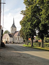 The church of Longvilliers | |
 Coat of arms | |
show Location of Longvilliers | |
 Longvilliers | |
| Coordinates: 50°32′40″N 1°43′42″E / 50.5444°N 1.7283°ECoordinates: 50°32′40″N 1°43′42″E / 50.5444°N 1.7283°E | |
| Country | France |
| Region | Hauts-de-France |
| Department | Pas-de-Calais |
| Arrondissement | Montreuil |
| Canton | Étaples |
| Intercommunality | CA Deux Baies en Montreuillois |
| Government | |
| • Mayor (2020–2026) | Philippe Petit |
| Area 1 | 10.99 km2 (4.24 sq mi) |
| Population (Jan. 2018)[1] | 250 |
| • Density | 23/km2 (59/sq mi) |
| Time zone | UTC+01:00 (CET) |
| • Summer (DST) | UTC+02:00 (CEST) |
| INSEE/Postal code | 62527 /62630 |
| Elevation | 19–120 m (62–394 ft) (avg. 40 m or 130 ft) |
| 1 French Land Register data, which excludes lakes, ponds, glaciers > 1 km2 (0.386 sq mi or 247 acres) and river estuaries. | |


Longvilliers (until 1997 Longvillers) is a commune in the Pas-de-Calais department in the Hauts-de-France region of France.
Geography[]
Longvilliers is situated 5 miles (9 km) north of Montreuil-sur-Mer on the D146 road and in the river valley. With a population of little over 250, it retains the character and atmosphere of the French countryside. There are no shops, but it is near enough to Frencq (5 km), Montreuil-sur-Mer (9 km) and Étaples (10 km). The area around offers stunning views and walks into the rolling countryside.
Population[]
| Year | Pop. | ±% p.a. |
|---|---|---|
| 1968 | 297 | — |
| 1975 | 263 | −1.72% |
| 1982 | 243 | −1.12% |
| 1990 | 244 | +0.05% |
| 1999 | 250 | +0.27% |
| 2007 | 229 | −1.09% |
| 2012 | 263 | +2.81% |
| 2017 | 247 | −1.25% |
| Source: INSEE[2] | ||
Places of interest[]
- The beautiful fifteenth-century church.
- Ruins of the 16th-century château.
- Vestiges of a cistercian abbey from the twelfth century.
- Remains of the manor of Tatéville, of 1586.
See also[]
References[]
- ^ "Populations légales 2018". INSEE. 28 December 2020.
- ^ Population en historique depuis 1968, INSEE
External links[]
| Wikimedia Commons has media related to Longvilliers (Pas-de-Calais). |
This Pas-de-Calais geographical article is a stub. You can help Wikipedia by . |
Categories:
- Communes of Pas-de-Calais
- Pas-de-Calais geography stubs