Mazinghem
Mazinghem | |
|---|---|
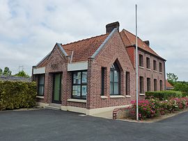 The town hall of Mazinghem | |
 Coat of arms | |
show Location of Mazinghem | |
 Mazinghem | |
| Coordinates: 50°36′14″N 2°24′20″E / 50.6039°N 2.4056°ECoordinates: 50°36′14″N 2°24′20″E / 50.6039°N 2.4056°E | |
| Country | France |
| Region | Hauts-de-France |
| Department | Pas-de-Calais |
| Arrondissement | Béthune |
| Canton | Aire-sur-la-Lys |
| Intercommunality | CA Béthune-Bruay, Artois-Lys Romane |
| Government | |
| • Mayor (2020–2026) | Claudette Matton[1] |
| Area 1 | 5.19 km2 (2.00 sq mi) |
| Population (Jan. 2018)[2] | 471 |
| • Density | 91/km2 (240/sq mi) |
| Time zone | UTC+01:00 (CET) |
| • Summer (DST) | UTC+02:00 (CEST) |
| INSEE/Postal code | 62564 /62120 |
| Elevation | 19–57 m (62–187 ft) (avg. 29 m or 95 ft) |
| 1 French Land Register data, which excludes lakes, ponds, glaciers > 1 km2 (0.386 sq mi or 247 acres) and river estuaries. | |


Mazinghem is a commune in the Pas-de-Calais department in the Hauts-de-France region of France.
Geography[]
Mazinghem is situated some 12 miles (19.3 km) northwest of Béthune and 33 miles (53.1 km) west of Lille, at the junction of the D943 and D186 roads.
Population[]
| Year | Pop. | ±% p.a. |
|---|---|---|
| 1968 | 286 | — |
| 1975 | 298 | +0.59% |
| 1982 | 325 | +1.25% |
| 1990 | 321 | −0.15% |
| 1999 | 337 | +0.54% |
| 2007 | 410 | +2.48% |
| 2012 | 486 | +3.46% |
| 2017 | 474 | −0.50% |
| Source: INSEE[3] | ||
Places of interest[]
- The church of Notre-Dame-de-l'Annonciation, dating from the twelfth century.
- Some remains of a medieval chateau.
- The eighteenth-century chateau.
See also[]
References[]
- ^ "Répertoire national des élus: les maires". data.gouv.fr, Plateforme ouverte des données publiques françaises (in French). 2 December 2020. Retrieved 7 December 2020.
- ^ "Populations légales 2018". INSEE. 28 December 2020.
- ^ Population en historique depuis 1968, INSEE
| show Authority control |
|---|
This Pas-de-Calais geographical article is a stub. You can help Wikipedia by . |
Categories:
- Communes of Pas-de-Calais
- Pas-de-Calais geography stubs