Neuville-au-Cornet
Neuville-au-Cornet | |
|---|---|
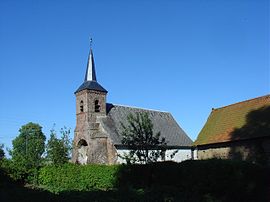 The church of Neuville-au-Cornet | |
 Coat of arms | |
show Location of Neuville-au-Cornet | |
 Neuville-au-Cornet | |
| Coordinates: 50°20′12″N 2°22′08″E / 50.3367°N 2.3689°ECoordinates: 50°20′12″N 2°22′08″E / 50.3367°N 2.3689°E | |
| Country | France |
| Region | Hauts-de-France |
| Department | Pas-de-Calais |
| Arrondissement | Arras |
| Canton | Saint-Pol-sur-Ternoise |
| Intercommunality | CC Ternois |
| Government | |
| • Mayor (2020–2026) | Régis Marquet[1] |
| Area 1 | 2.28 km2 (0.88 sq mi) |
| Population (Jan. 2018)[2] | 69 |
| • Density | 30/km2 (78/sq mi) |
| Time zone | UTC+01:00 (CET) |
| • Summer (DST) | UTC+02:00 (CEST) |
| INSEE/Postal code | 62607 /62170 |
| Elevation | 139–152 m (456–499 ft) (avg. 146 m or 479 ft) |
| 1 French Land Register data, which excludes lakes, ponds, glaciers > 1 km2 (0.386 sq mi or 247 acres) and river estuaries. | |


Neuville-au-Cornet is a commune in the Pas-de-Calais department in the Hauts-de-France region of France.
Geography[]
Neuville-au-Cornet is situated 24 miles (39 km) west of Arras, at the junction of the D85 and D83 roads.
Population[]
| Year | Pop. | ±% p.a. |
|---|---|---|
| 1968 | 65 | — |
| 1975 | 65 | +0.00% |
| 1982 | 65 | +0.00% |
| 1990 | 78 | +2.31% |
| 1999 | 66 | −1.84% |
| 2007 | 78 | +2.11% |
| 2012 | 87 | +2.21% |
| 2017 | 71 | −3.98% |
| Source: INSEE[3] | ||
Places of interest[]
- The church of Notre-Dame, dating from the seventeenth century.
- The chapel of the virgin, also dating from the seventeenth century.
See also[]
References[]
- ^ "Répertoire national des élus: les maires". data.gouv.fr, Plateforme ouverte des données publiques françaises (in French). 2 December 2020. Retrieved 7 December 2020.
- ^ "Populations légales 2018". INSEE. 28 December 2020.
- ^ Population en historique depuis 1968, INSEE
| Wikimedia Commons has media related to Neuville-au-Cornet. |
This Arras arrondissement, Pas-de-Calais geographical article is a stub. You can help Wikipedia by . |
Categories:
- Communes of Pas-de-Calais
- Arras arrondissement geography stubs