Puisieux, Pas-de-Calais
Puisieux | |
|---|---|
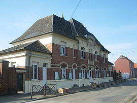 The town hall of Puisieux | |
 Coat of arms | |
show Location of Puisieux | |
 Puisieux | |
| Coordinates: 50°07′00″N 2°41′44″E / 50.1167°N 2.6956°ECoordinates: 50°07′00″N 2°41′44″E / 50.1167°N 2.6956°E | |
| Country | France |
| Region | Hauts-de-France |
| Department | Pas-de-Calais |
| Arrondissement | Arras |
| Canton | Avesnes-le-Comte |
| Intercommunality | CC Sud-Artois |
| Government | |
| • Mayor (2020–2026) | Jacques Bonnay |
| Area 1 | 11.69 km2 (4.51 sq mi) |
| Population (Jan. 2018)[1] | 654 |
| • Density | 56/km2 (140/sq mi) |
| Time zone | UTC+01:00 (CET) |
| • Summer (DST) | UTC+02:00 (CEST) |
| INSEE/Postal code | 62672 /62116 |
| Elevation | 77–147 m (253–482 ft) (avg. 128 m or 420 ft) |
| 1 French Land Register data, which excludes lakes, ponds, glaciers > 1 km2 (0.386 sq mi or 247 acres) and river estuaries. | |


Puisieux (French pronunciation: [pɥizjø] (![]() listen)) or Puisieux-au-Mont is a commune in the Pas-de-Calais department in the Hauts-de-France region of France.
listen)) or Puisieux-au-Mont is a commune in the Pas-de-Calais department in the Hauts-de-France region of France.
Geography[]
Puisieux is situated 14 miles (23 km) south of Arras, at the junction of the D919, D27 and D6 roads.
Population[]
| Year | Pop. | ±% p.a. |
|---|---|---|
| 1968 | 629 | — |
| 1975 | 599 | −0.70% |
| 1982 | 658 | +1.35% |
| 1990 | 613 | −0.88% |
| 1999 | 609 | −0.07% |
| 2007 | 628 | +0.38% |
| 2012 | 696 | +2.08% |
| 2017 | 661 | −1.03% |
| Source: INSEE[2] | ||
Places of interest[]
- The church of St. Denis, rebuilt, as was the rest of the village, after the First World War.
- The Commonwealth War Graves Commission cemeteries (including Queens Cemetery).
- A war memorial.
See also[]
References[]
- ^ "Populations légales 2018". INSEE. 28 December 2020.
- ^ Population en historique depuis 1968, INSEE
External links[]
| Wikimedia Commons has media related to Puisieux (Pas-de-Calais). |
- Serre Road CWGC cemetery No. 3
- Serre Road CWGC cemetery No. 2
- Serre Road CWGC cemetery No. 1
- The Queens CWGC cemetery
- The CWGC communal cemetery
- Puisieux on the Quid website (in French)
This Arras arrondissement, Pas-de-Calais geographical article is a stub. You can help Wikipedia by . |
Categories:
- Communes of Pas-de-Calais
- Arras arrondissement geography stubs